 EEA geospatial data catalogue
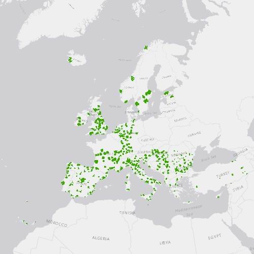
Urban Atlas Street Tree Layer 2018 (vector), Europe, 6-yearly, Feb. 2021
The Urban Atlas provides pan-European comparable land use and land cover data for Functional Urban Areas (FUA) across EEA38 countries (EU, EFTA, Western Balkan countries as well as Türkiye) and United Kingdom. The Street Tree Layer (STL) is a separate layer from the Urban Atlas 2018 LU/LC layer produced within the level 1 urban mask for each FUA. It includes contiguous rows or a patches of trees covering 500 m² or more and with a minimum width of 10 meter over 'Artificial surfaces' (nomenclature class 1) inside FUA (i.e. rows of trees along the road network outside urban areas or forest adjacent to urban areas should not be included).
Urban Atlas is a joint initiative of the European Commission Directorate-General for Regional and Urban Policy and the Directorate-General for Defence Industry and Space in the frame of the EU Copernicus programme, with the support of the European Space Agency and the European Environment Agency.
Simple
Identification info
- Date (Creation)
- 2020-05-06
- Date (Publication)
- 2020-05-06
- Date (Revision)
- 2021-02-04
- Edition
-
01.02
- Citation identifier
- copernicus_v_3035_10_m_ua-stl-2018_p_2017-2018_v01_r02
- Citation identifier
- DAT-190-en
Identifier
- Point of contact
-
Organisation Individual Electronic mail address Website Role European Commission
Owner Copernicus Land Monitoring Service
Custodian European Environment Agency
Publisher Copernicus Land Monitoring Service helpdesk
Point of contact
- Spatial representation type
- Vector
Spatial resolution
- Spatial resolution
- 10 m
- Topic category
-
- Environment
- Imagery base maps earth cover
Extent
Temporal extent
- Time period
- 2017-01-01 2018-12-31
Extent
))
Extent
))
Extent
))
- Maintenance and update frequency
- Continual
- GEMET - INSPIRE themes, version 1.0
-
-
Land use
-
- Continents, countries, sea regions of the world.
-
-
United Kingdom
-
EEA38 (from 2020)
-
- GEMET
-
-
land use
-
urban area
-
land cover
-
landscape alteration
-
- EEA topics
-
-
Land use
-
- EEA Management Plan
-
-
2018 3.6.2
-
Resource constraints
- Access constraints
- Other restrictions
- Other constraints
- no limitations to public access
Resource constraints
- Use constraints
- Other restrictions
- Other constraints
-
The Copernicus component is governed by Regulation (EU) No 2021/696 of the European Parliament and of the Council of 28 April 2021 establishing the Union Space Programme and the European Union Agency for the Space Programme and repealing Regulations (EU) No 912/2010, (EU) No 1285/2013 and (EU) No 377/2014 and Decision No 541/2014/EU. Within the Copernicus component, a portfolio of land monitoring activities has been delegated by the European Union to the European Environment Agency (EEA) and the DG Joint Research Centre of the European Commission.
The Copernicus land monitoring products and services are made available on a principle of full, open and free access, as established by the Commission Delegated Regulation (EU) No 1159/2013 of 12 July 2013.
Free, full and open access to the products and services of the Copernicus Land Monitoring Service is made on the conditions that:
1. When distributing or communicating Copernicus Land Monitoring Service products and services (data, software scripts, web services, user and methodological documentation and similar) to the public, users shall inform the public of the source of these products and services.
2. Where the Copernicus Land Monitoring Service products and services have been adapted or modified by the user, the user shall clearly state this.
3. Users shall make sure not to convey the impression to the public that the user's activities are officially endorsed by the European Union.
Associated resource
- Association Type
- Cross reference
- Metadata Reference
- Language
- English
- Character encoding
- UTF8
- Additional Information
-
Spatial Resolution information: The Minimum Mapping Width is 10 m
Distribution Information
- Distribution format
-
-
Geopackage
-
- OnLine resource
-
Product Information & Technical Documentation
- OnLine resource
-
STL 2018 Vector
- OnLine resource
-
CLMS Website
Download (requires authentication)
Data quality info
- Hierarchy level
- Dataset
Report
Result
- Title
- Commission Regulation (EU) No 1089/2010 of 23 November 2010 implementing Directive 2007/2/EC of the European Parliament and of the Council as regards interoperability of spatial data sets and services
- Date (Publication)
- 2010-12-08
- Explanation
-
See the referenced specification
Resource lineage
- Statement
-
Cartography based on satellite images Interpretation (Pléiades, KOMPSAT, Planet, SPOT6, SuperView, etc. - resolution 2 or 4 meters)
Use of ancillary data (Google Earth, OpenStreet Map).
Production Street Tree Layer for Functional Urban Area in Europe.
The Minimum Mapping Unit is 500 m2. The Minimum Mapping Width is 10 m.
- Hierarchy level
- Dataset
Reference System Information
Reference System Information
- Code
- EPSG:3035
Reference System Information
Reference System Information
- Code
- EPSG:32620
Reference System Information
Reference System Information
- Code
- EPSG:32740
- Maintenance and update frequency
Metadata
- Metadata identifier
- 205691b3-7ae9-41dd-abf1-1fbf60d72c8c
- Language
- English
- Character encoding
- UTF8
- Contact
-
Organisation Individual Electronic mail address Website Role European Environment Agency
Point of contact
Type of resource
- Resource type
- Dataset
- Metadata linkage
-
https://sdi.eea.europa.eu/catalogue/srv/api/records/205691b3-7ae9-41dd-abf1-1fbf60d72c8c
- Date info (Creation)
- 2020-05-11T10:05:37Z
- Date info (Revision)
- 2025-10-09T10:40:06.588242Z
Metadata standard
- Title
-
ISO 19115/19139
- Edition
-
1.0
),POLYGON((-60.6807%2014.3109,-60.6807%2014.9152,-61.2564%2014.9152,-61.2564%2014.3109,-60.6807%2014.3109)),POLYGON((55.769%20-21.2979,55.769%20-20.7244,55.3183%20-20.7244,55.3183%20-21.2979,55.769%20-21.2979))))