 EEA geospatial data catalogue
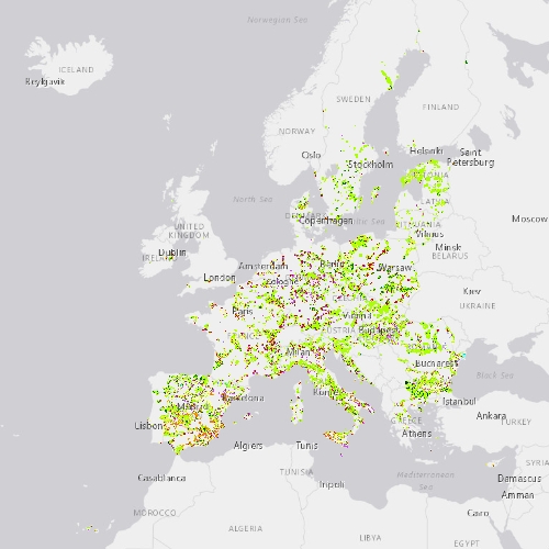
N2K Change 2012-2018 (vector), Europe, 6-yearly, Jul. 2021
This metadata refers to the CLMS N2K Change 2012-2018 product, the Copernicus Land Cover/Land Use (LC/LU) change map tailored to the needs of biodiversity monitoring in selected Natura2000 sites: 4790 sites of natural and semi-natural grassland formations listed in Annex I of the Habitats Directive, including a 2km buffer zone surrounding the sites. The change mapping exercise between the reference years 2012 and 2018, was based on the comparison of VHR satellite data and occurred over an area of 631.800 km² across Europe (i.e. EU27, the United Kingdom and Switzerland). The change dataset only shows the areas that have changed between 2012 and 2018 and covers an area of 1.199.652 ha.
LC/LU is extracted from VHR satellite data and other available data. Change detection is based on the analysis of VHR satellite data from the reference years 2012 ±2 years and 2018 ±1 year.
The production of N2K updates was coordinated by the European Environment Agency (EEA) in the frame of the EU Copernicus programme.
Simple
Identification info
-
Date (Creation)
- 2021-07-16
-
Date (Publication)
- 2021-07-16
-
Edition
-
01.00
-
Citation identifier
- copernicus_v_3035_10_m_n2k-cha-2012-2018_p_2010-2019_v01_r00
Identifier
- Point of contact
-
Organisation Individual Electronic mail address Website Role European Commission
OwnerCopernicus Land Monitoring Service
CustodianEuropean Environment Agency
PublisherCopernicus Land Monitoring Service helpdesk
Point of contact
-
Spatial representation type
-
Vector
Spatial resolution
-
Spatial resolution
- 10 m
-
Topic category
-
-
Environment
-
Imagery base maps earth cover
-
Extent
Temporal extent
-
Time period
- 2010-01-01 2019-12-31
Extent
))
-
Maintenance and update frequency
-
Continual
- GEMET - INSPIRE themes, version 1.0
-
-
Land cover
-
Protected sites
-
- Continents, countries, sea regions of the world.
-
-
United Kingdom
-
Switzerland
-
EU27 (from 2020)
-
- GEMET
-
-
natural area
-
landscape alteration
-
protected area
-
land use
-
habitat
-
species
-
natural areas protection
-
- EEA topics
-
-
Biodiversity
-
Land use
-
Resource constraints
-
Access constraints
-
Other restrictions
-
Other constraints
- no limitations to public access
Resource constraints
-
Use constraints
-
Other restrictions
-
Other constraints
-
The Copernicus component is governed by Regulation (EU) No 2021/696 of the European Parliament and of the Council of 28 April 2021 establishing the Union Space Programme and the European Union Agency for the Space Programme and repealing Regulations (EU) No 912/2010, (EU) No 1285/2013 and (EU) No 377/2014 and Decision No 541/2014/EU. Within the Copernicus component, a portfolio of land monitoring activities has been delegated by the European Union to the European Environment Agency (EEA) and the DG Joint Research Centre of the European Commission.
The Copernicus land monitoring products and services are made available on a principle of full, open and free access, as established by the Commission Delegated Regulation (EU) No 1159/2013 of 12 July 2013.
Free, full and open access to the products and services of the Copernicus Land Monitoring Service is made on the conditions that:
1. When distributing or communicating Copernicus Land Monitoring Service products and services (data, software scripts, web services, user and methodological documentation and similar) to the public, users shall inform the public of the source of these products and services.
2. Where the Copernicus Land Monitoring Service products and services have been adapted or modified by the user, the user shall clearly state this.
3. Users shall make sure not to convey the impression to the public that the user's activities are officially endorsed by the European Union.
-
Language
- English
-
Character encoding
-
UTF8
-
Additional Information
-
Spatial Resolution information: The Minimum Mapping Width is 10 m
Distribution Information
-
Distribution format
-
-
GDB
-
Spatialite
-
-
OnLine resource
-
CLMS Website
Download (requires authentication)
-
OnLine resource
-
Product Information & Technical Documentation
Data quality info
-
Hierarchy level
-
Dataset
Report
Result
-
Title
- Commission Regulation (EU) No 1089/2010 of 23 November 2010 implementing Directive 2007/2/EC of the European Parliament and of the Council as regards interoperability of spatial data sets and services
-
Date (Publication)
- 2010-12-08
-
Explanation
-
See the referenced specification
Resource lineage
-
Statement
-
Computer assisted change detection of LC/LU between the reference years 2012 and 2018 extracted from VHR satellite data and other available data. The change mapping exercise between the reference years 2012 and 2018, was based on the comparison of VHR satellite data and occurred over an area of 631.800 km² across Europe (i.e. within the selected Natura2000 sites and including a 2km buffer zone surrounding those). The change dataset only shows the areas that have changed between 2012 and 2018 and covers an area of 1.199.652 ha. The production of this dataset is the basis for the status map 2018 as well as for the revision of the previous time steps 2012 and 2006.
The classification provides 55 distinct thematic classes. The class definitions follow a pre-defined nomenclature based on the Mapping and Assessment of Ecosystems and their Services (MAES) typology of ecosystems (at level 1) and are further harmonised with Corine Land Cover and adapted to the specific characteristics of grasslands habitats (levels 2 to 4). Each change polygon is identified with a change code that shows the initial class and the change class. The Minimum Mapping Unit (MMU) is 0.5 ha and the Minimum Mapping Width (MMW) is 10 m. The positional accuracy is less than 5 m (according to geo-location accuracy of satellite imagery delivered by ESA: less than 5m RMSE). Producer’s accuracy assessment approach: stratified random point sampling. Interpretation of sampling points was performed on the best available reference data. The overall accuracy is higher than 80%.
-
Hierarchy level
-
Dataset
Reference System Information
Reference System Information
-
Code
- EPSG:3035
-
Maintenance and update frequency
Metadata
-
Metadata identifier
- 2fff6d41-eeb6-430e-8740-090f0d4284a2
-
Language
- English
-
Character encoding
-
UTF8
- Contact
-
Organisation Individual Electronic mail address Website Role European Environment Agency
Point of contact
Type of resource
-
Resource type
-
Dataset
-
Metadata linkage
-
https://sdi.eea.europa.eu/catalogue/srv/api/records/2fff6d41-eeb6-430e-8740-090f0d4284a2
-
Date info (Creation)
- 2021-07-29T14:40:07.215Z
-
Date info (Revision)
- 2025-10-09T10:43:52.918809Z
Metadata standard
-
Title
-
ISO 19115/19139
-
Edition
-
1.0
)))