 EEA geospatial data catalogue
GISCO - Communes 2010, Aug. 2012
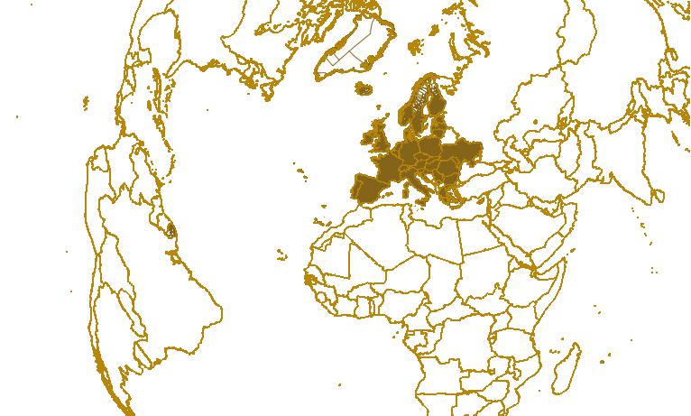
This data set shows pan European administrative boundaries down to commune level version 2010. Communes are equivalent to Local Administrative Units, level 2 (LAU2), except for GR (LAU1) and SI (so called LAU3). The Nomenclature of Territorial Units for Statistics (NUTS) and the LAU nomenclature are hierarchical classifications of statistical regions that together subdivide the EU economic territory into regions of five different levels (NUTS 1, 2 and 3 and LAU 1, 2, respectively, moving from larger to smaller territorial units). The NUTS classification has been officially established through Regulation (EC) No 1059/2003 of the European Parliament and of the Council and amendments. A non official NUTS-like classification has been defined for the non-EU countries. The LAU classification is not covered by any legislative act. An introduction to the NUTS classification is available here: http://epp.eurostat.ec.europa.eu/portal/page/portal/nuts_nomenclature/introduction The data set is based on EuroBoundaryMap v. 5.0 from Eurogeographics. Geographical extent covers the European Union 27, EFTA countries, Croatia, Serbia (including Kosovo UNSCR 1244) Greenland, Moldova and Ukraine. The scale of the data set is 1:100 000. The data set (100K - 60M) is available to EEA due to EEA having a valid EBM v5.0 licence.
These metadata are derived from the original metadata records available at Inspire@EC.
Simple
Identification info
- Date (Creation)
- 2012-08-17
- Citation identifier
- eurostat_v_4258_x_x_gisco-communes_2010
- Status
- Superseded
- Spatial representation type
- Vector
Spatial resolution
Equivalent scale
- Denominator
- 100000
Spatial resolution
Equivalent scale
- Denominator
- 3000000
Spatial resolution
Equivalent scale
- Denominator
- 10000000
Spatial resolution
Equivalent scale
- Denominator
- 20000000
Spatial resolution
Equivalent scale
- Denominator
- 1000000
Spatial resolution
Equivalent scale
- Denominator
- 60000000
- Topic category
-
- Boundaries
Extent
))
Extent
Temporal extent
- Time period
- 2010-01-01 2010-12-31
- GEMET - INSPIRE themes, version 1.0
-
-
Administrative units
-
- GEMET
-
-
administrative boundary
-
Resource constraints
- Use limitation
-
This data set should be referred to as "Communes, 2010 - European Commission, Eurostat/GISCO". An overview of the use conditions is given below. The detailed use conditions are available here: https://circabc.europa.eu/d/d/workspace/SpacesStore/6f5186f3-908b-413a-8687-191604976751/EuroGeographics%20Use%20Conditions%20-%20From%20Contract.pdf Access to the detailed data is restricted to the personnel of the European Commission, the Executive Agencies and contractors, due to intellectual property rights. The contractors can access the data after signing an agreement form. The agreement form can be requested by the responsible service from European Commission - Eurostat/GISCO ( ESTAT-GISCO@ec.europa.eu). Once the form has been signed, access will be provided by European Commission - Eurostat/GISCO. Data can be published in the form of electronic images, statistical tables and on paper. Subsets of this data can be made available to the general public for non commercial use, only if the data covered either has a spatial resolution of 1:1.000.000 or smaller, or less than 20% of the original EuroGeographics data is shown for the selected extent. The source and intellectual property have always to be acknowledged. To this end, an acknowledgement as specified below must be visible on any printed or electronic publication using the data. Acknowledgement notice, depending on the language used in the publication: English: Administrative boundaries: © EuroGeographics Source: European Commission – Eurostat/GISCO French: Limites administratives: © EuroGeographics Source: Commission européenne – Eurostat/GISCO German: Verwaltungsgrenzen: © EuroGeographics Quelle: Europäische Kommission - Eurostat/GISCO For publications in languages other than English, French or German, the translation of the acknowledgement notice in the language of the publication must be used
Resource constraints
- Access constraints
- intellectualPropertyRights
Associated resource
- Association Type
- Larger work citation
- Metadata Reference
- Language
- English
- Character encoding
- UTF8
Distribution Information
- Distribution format
-
-
GDB
-
- OnLine resource
-
Direct download (Eionet authentication)
Data quality info
- Hierarchy level
- Dataset
Report
Result
- Title
-
Commission Regulation (EU) No 1089/2010 of 23 November 2010 implementing Directive 2007/2/EC of the European Parliament and of the Council as regards interoperability of spatial data sets and services
- Date (Publication)
- 2010-12-08
- Explanation
-
See the referenced specification
Resource lineage
- Statement
-
The dataset is based on the geometry from EuroBoundary Map v5.0 (source EuroGeographics). This dataset was integrated in a common repository of geometry (including country and EEZ boundaries) of which the different datasets were derived. The different scale levels were derived of generalisations of the common repository on 100K scale. This means that within each scale level the feature classes of all these datasets: COMM_2010, NUTS_2010, CNTR_2010, EEZ_2010 and COAS_2010, are fully coherent and compliant. Each scale level in the COMM_2010 dataset consists of 2 feature classes (regions and boundaries) The boundaries and regions are related to each other through a relationship table. In addition to the region and boundary feature classes there is also 1 label feature class which is scale independent. For each Commune in the region feature class there is exactly 1 label. Further information on the validity and lineage is available in the database manual on the INSPIRE@EC group on CIRCABC. https://circabc.europa.eu/w/browse/bf8ae55b-a09b-4f24-a0b8-1f5784e0080c
- Hierarchy level
- Dataset
Reference System Information
- Reference system identifier
- OGP Surveying & Positioning Committee/urn:ogc:def:crs:EPSG:7.1:4258
Metadata
- Metadata identifier
- b4d44141-e5c0-4e23-b11e-d64c5087c413
- Language
- English
- Character encoding
- UTF8
- Contact
-
Organisation Individual Electronic mail address Website Role European Environment Agency
Point of contact
Type of resource
- Resource type
- Dataset
- Metadata linkage
-
https://sdi.eea.europa.eu/catalogue/srv/api/records/b4d44141-e5c0-4e23-b11e-d64c5087c413
- Date info (Creation)
- 2012-08-21T17:10:54Z
- Date info (Revision)
- 2025-10-09T11:10:00.865112Z
Metadata standard
- Title
-
ISO 19115/19139
- Edition
-
1.0
)))