 EEA geospatial data catalogue
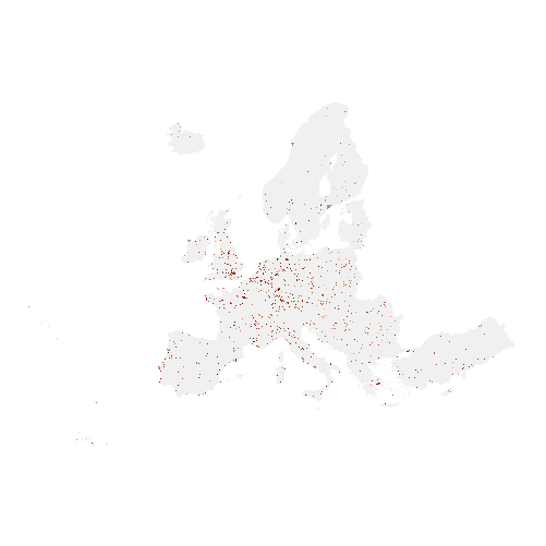
Imperviousness Density 2009 (raster 100 m), Europe, 3-yearly, Apr. 2018
The high resolution imperviousness products capture the percentage and change of soil sealing. Built-up areas are characterized by the substitution of the original (semi-) natural land cover or water surface with an artificial, often impervious cover. These artificial surfaces are usually maintained over long periods of time. A series of high resolution imperviousness datasets (for the 2006, 2009, 2012, 2015 and 2018 reference years) with all artificially sealed areas was produced using automatic derivation based on calibrated Normalized Difference Vegetation Index (NDVI). This series of imperviousness layers constitutes the main status layers. They are per-pixel estimates of impermeable cover of soil (soil sealing) and are mapped as the degree of imperviousness (0-100%). Imperviousness change layers were produced as a difference between the reference years (2006-2009, 2009-2012, 2012-2015, 2015-2018 and additionally 2006-2012, to fully match the CORINE Land Cover production cycle) and are presented 1) as degree of imperviousness change (-100% -- +100%), in 20m and 100m pixel size, and 2) a classified (categorical) 20m change product.
Simple
Identification info
- Date (Creation)
- 2018-04-06
- Date (Publication)
- 2018-04-06
- Edition
-
03.00
- Citation identifier
- copernicus_r_3035_100_m_imd-2009_p_2008-2010_v03_r00
- Citation identifier
- DAT-14-en
Identifier
- Point of contact
-
Organisation Individual Electronic mail address Website Role European Commission
Owner Copernicus Land Monitoring Service
Custodian European Environment Agency
Publisher Copernicus Land Monitoring Service helpdesk
Point of contact
- Spatial representation type
- Grid
Spatial resolution
- Spatial resolution
- 100 m
- Topic category
-
- Environment
- Imagery base maps earth cover
Extent
Temporal extent
- Time period
- 2008-01-01 2010-12-31
Extent
))
))
- Maintenance and update frequency
- Continual
- GEMET - INSPIRE themes, version 1.0
-
-
Land cover
-
- Continents, countries, sea regions of the world.
-
-
EEA39
-
- GEMET
-
-
soil surface sealing
-
land cover
-
urban area
-
built environment
-
land use
-
landscape alteration
-
sealing
-
- EEA Management Plan
-
-
2018 3.6.1
-
- EEA topics
-
-
Buildings and construction
-
Land use
-
Soil
-
Resource constraints
- Access constraints
- Other restrictions
- Other constraints
- no limitations to public access
Resource constraints
- Use constraints
- Other restrictions
- Other constraints
-
The Copernicus component is governed by Regulation (EU) No 2021/696 of the European Parliament and of the Council of 28 April 2021 establishing the Union Space Programme and the European Union Agency for the Space Programme and repealing Regulations (EU) No 912/2010, (EU) No 1285/2013 and (EU) No 377/2014 and Decision No 541/2014/EU. Within the Copernicus component, a portfolio of land monitoring activities has been delegated by the European Union to the European Environment Agency (EEA) and the DG Joint Research Centre of the European Commission.
The Copernicus land monitoring products and services are made available on a principle of full, open and free access, as established by the Commission Delegated Regulation (EU) No 1159/2013 of 12 July 2013.
Free, full and open access to the products and services of the Copernicus Land Monitoring Service is made on the conditions that:
1. When distributing or communicating Copernicus Land Monitoring Service products and services (data, software scripts, web services, user and methodological documentation and similar) to the public, users shall inform the public of the source of these products and services.
2. Where the Copernicus Land Monitoring Service products and services have been adapted or modified by the user, the user shall clearly state this.
3. Users shall make sure not to convey the impression to the public that the user's activities are officially endorsed by the European Union.
- Language
- English
- Character encoding
- UTF8
Distribution Information
- Distribution format
-
-
GeoTIFF
-
- OnLine resource
-
CLMS Website
Download (requires authentication)
- OnLine resource
-
Product Information & Technical Documentation
- OnLine resource
-
0
Imperviousness density 2009
Data quality info
- Hierarchy level
- Dataset
Report
Result
- Title
- Commission Regulation (EU) No 1089/2010 of 23 November 2010 implementing Directive 2007/2/EC of the European Parliament and of the Council as regards interoperability of spatial data sets and services
- Date (Publication)
- 2010-12-08
- Explanation
-
See the referenced specification
Resource lineage
- Statement
-
Quality assurance follows the ISO9000 standards for Quality Management and comprises of dedicated procedures of ongoing quality checks (QA breakpoints) during implementation of the production chain, in order to keep persistent control over the various stages of production, assure fitness-for-purpose of the end-products and that all quality requirements are fulfilled. Priority has been given to the target thematic accuracies to be achieved by each product, as well as to the issues of product consistency (spatial, thematic, temporal) and homogeneity. Quality Assessment: The quality assessment has been performed according to INSPIRE Data Specifications. The data quality elements considered are:
(i) Completeness,
(ii) Logical Consistency,
(iii) Thematic Accuracy,
(iv) Temporal quality and
(v) Usability.
Each of them (excl. the Thematic Accuracy hereafter) forms a section in the QA/QC Procedures.
- Hierarchy level
- Dataset
Reference System Information
Reference System Information
- Code
- EPSG:3035
- Maintenance and update frequency
Metadata
- Metadata identifier
- bd1c6abc-a413-489a-91c7-e2690e01ff0e
- Language
- English
- Character encoding
- UTF8
- Contact
-
Organisation Individual Electronic mail address Website Role European Environment Agency
Point of contact
Type of resource
- Resource type
- Dataset
- Metadata linkage
-
https://sdi.eea.europa.eu/catalogue/srv/api/records/bd1c6abc-a413-489a-91c7-e2690e01ff0e
- Date info (Creation)
- 2018-06-12T15:04:43Z
- Date info (Revision)
- 2025-10-09T11:11:59.449499Z
Metadata standard
- Title
-
ISO 19115/19139
- Edition
-
1.0
),POLYGON((44.8212%2034.5619,44.8212%2071.1855,-10.6198%2071.1855,-10.6198%2034.5619,44.8212%2034.5619))))