 EEA geospatial data catalogue
Nationally designated areas for public access (tabular data) - July 2026
The European inventory of Nationally designated areas holds information about protected designated areas and their designation types, which directly or indirectly create protected areas. The Nationally designated areas' dataset is the official source of protected area information from the 38 European countries*, members of the Eionet, to the World Database of Protected Areas (WDPA).
This metadata refers to the public version of the Nationally designated areas dataset version 24 (2026). The EEA does not have permission to distribute some or all sites reported by Estonia, Ireland and Türkiye. The internal version of this dataset from which this dataset is derived, contains all designated areas and its access is restricted.
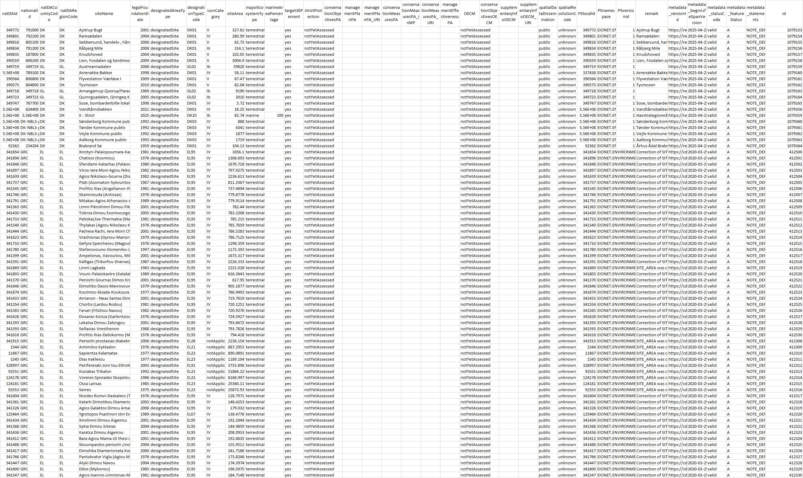
The dataset contains tabular data: NatDA_2026_v01_public_DesignatedArea.csv, which includes information on the nationally designated sites and designated boundaries for public dissemination; and NatDA_2026_v01_public_DesignationType.csv, which contains information about designation types and the national and international legislative instruments, which directly or indirectly create protected designated areas in Europe.
This dataset is the accompaniment to two versions of publicly accessible spatial data: https://sdi.eea.europa.eu/catalogue/srv/eng/catalog.search#/metadata/028003e7-7585-4d69-92fc-7f81e0cc2340
* Including Kosovo (UNSCR 1244/99), which designation is without prejudice to positions on status, and is in line with UNSCR 1244 and the ICJ Opinion on the Kosovo Declaration of Independence.
Simple
Identification info
- Date (Creation)
- 2026-07-01
- Date (Publication)
- 2026-07-10
- Edition
-
24.00
- Citation identifier
- eea_t_natda-areas_p_2025-2026_v24_r00
Identifier
- Codespace
-
doi.org
- Description
-
Digital Object Identifier (DOI)
- Point of contact
-
Organisation Individual Electronic mail address Website Role European Environment Agency
Point of contact European Environment Agency
Custodian
- Topic category
-
- Environment
Extent
Temporal extent
- Time period
- 2025-03-16 2026-04-15
- Maintenance and update frequency
- Annually
Resource constraints
- Use constraints
- Other restrictions
- Other constraints
-
License CC-BY 4.0 ( https://creativecommons.org/licenses/by/4.0/). Copyright holder: European Environment Agency (EEA).
- Language
- English
Distribution Information
- Distribution format
-
-
ascii (.csv, .txt, .sql)
-
- OnLine resource
-
https://sdi.eea.europa.eu/webdav/datastore/public/eea_t_natda-areas_p_2025-2026_v24_r00
- OnLine resource
-
Direct download
- OnLine resource
-
File including table and field definitions
- OnLine resource
-
Legal or equivalent instruments used by countries for the designation of protected and conserved areas
Dashboard
- OnLine resource
-
Digital Object Identifier (DOI)
Resource lineage
- Statement
-
The data sources for this dataset are data deliveries from the Eionet, the partnership network of the EEA and its 38 member and cooperating countries. In EU Member States the implementation of INSPIRE Directive may mean that the spatial information is provided via the national or sub-national INSPIRE data providers.
The reference data used in the validation process is the EBM 2020, Jan. 2020 ( https://sdi.eea.europa.eu/catalogue/srv/eng/catalog.search#/metadata/3275ecdb-a6c5-4ffe-875f-c0b2bfcc5786).
The dataset is accompanied with a series of files and documents for download: NatDA_2026_v01_public_DesignatedArea.csv, which includes information on the nationally designated sites and designated boundaries for public dissemination; NatDA_2026_v01_public_DesignationType.csv, which contains information about designation types and the national and international legislative instruments, which directly or indirectly create protected designated areas in Europe.
- Hierarchy level
- Dataset
Metadata
- Metadata identifier
- e92c2b84-abee-4da2-b3fe-5be5f0f91066
- Language
- English
- Character encoding
- UTF8
- Contact
-
Organisation Individual Electronic mail address Website Role European Environment Agency
Point of contact
Type of resource
- Resource type
- Non geographic dataset
- Name
-
Tabular dataset
- Date info (Creation)
- 2026-07-09T14:46:32.470691Z
- Date info (Revision)
- 2026-08-11T08:22:01.503959Z
Metadata standard
- Title
-
ISO 19115/19139
- Edition
-
1.0
)