 EEA geospatial data catalogue
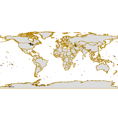
Global Administrative Unit Layers (GAUL), national level (level 0) for reference year 2008 - version 2009, Dec. 2008
The Global Administrative Unit Layers (GAUL) is an initiative implemented by FAO within the EC-FAO Food Security Programme funded by the European Commission ( http://www.foodsecinfoaction.org/News/news_06_06.htm). The GAUL aims at compiling and disseminating the most reliable spatial information on administrative units for all the countries in the world, providing a contribution to the standardization of the spatial dataset representing administrative units.
The GAUL always maintains global layers with a unified coding system at country, first (e.g. regions) and second administrative levels (e.g. districts). In addition, when data is available, it provides layers on a country by country basis down to third, fourth and lowers levels.
The GAUL is released once a year and the target beneficiary of the GAUL data is the UN community, the Universities and other authorized international and national institutions/agencies. Data might not be officially validated by authoritative national sources and can not be distributed to the general public. A disclaimer should always accompany any use of the GAUL data.
About 21 countries have been updated respect to the previous release (see countries_updated.dbf).
The GAUL keeps track of administrative units that has been changed, added or dismissed in the past for political causes. Changes implemented in different years are recorded in the GAUL on different layers. For this reason the GAUL product is not a single layer but a group of layers, named "GAUL Set" (see Gaul_Set.pdf).
The original dataset containing Level 0 administrative units has been combined by EEA with some attributes data provided within GAUL in a separate file. No data from outside GAUL have been used and it is possible to reconstruct the original dataset by removing the extra attributes added.
Simple
Identification info
- Date (Creation)
- 2008-12-10
- Edition
-
2009
- Citation identifier
- fao_v_4326_1_mio_gaul0_2008_rev2009
- Status
- Obsolete
- Spatial representation type
- Vector
Spatial resolution
Equivalent scale
- Denominator
- 1000000
- Topic category
-
- Boundaries
Extent
))
Extent
Temporal extent
- Time period
- 2008-01-01 2008-12-31
- Maintenance and update frequency
- Annually
Resource constraints
- Use limitation
-
License
Resource constraints
- Access constraints
- copyright
- Access constraints
- Other restrictions
- Use constraints
- license
- Other constraints
-
DEFAULT STATEMENT from FAO
The Global Administrative Unit Layers (GAUL) provides the most reliable spatial information on administrative units for all countries in the world. The GAUL dataset is for the benefit of the United Nations and other authorized international and national institutions/agencies. The Food and Agriculture Organization of the United Nations (FAO) hereby grants you a licence to use, download and print the materials contained in the GAUL dataset solely for your own non-commercial purposes and in accordance with the conditions listed below. Copyrighted data made available to you through the GAUL dataset is subject to the conditions specified in the metadata. The licencee will at all times use due diligence to safeguard and protect all such confidential and proprietary information pertaining to the Licensed Data. Except as may otherwise be expressly permitted by applicable law, all redistribution to non-authorized users or commercial exploitation of any material contained in the GAUL dataset is strictly prohibited without the prior written consent of FAO. Any request for permission to reproduce or otherwise use any material contained in or otherwise made available to you through the GAUL dataset other than as provided for herein, should be directed to FAO. The full GAUL Data License document is available for downloading.
++++++++++++++++++
It has been agreed between EEA (HP) and FAO that EEA may use GAUL vector data and publish derived products, as defined in the license agreement. Published derived products will contain an appropriate attribution statement: "derived from the Global Administrative Unit Layers (GAUL) dataset, implemented by FAO."
- Language
- English
- Character encoding
- UTF8
Distribution Information
- Distribution format
-
-
Postgis
-
- OnLine resource
-
Direct download (Eionet authentication)
Data quality info
- Hierarchy level
- Dataset
Report
Result
- Title
- Commission Regulation (EU) No 1089/2010 of 23 November 2010 implementing Directive 2007/2/EC of the European Parliament and of the Council as regards interoperability of spatial data sets and services
- Date (Publication)
- 2010-12-08
- Explanation
-
See the referenced specification
Resource lineage
- Statement
-
The overall methodology consists in
a) collecting the best available data from most reliable sources,
b) establishing validation periods of the geographic features (when possible),
c) adding selected data to the global layer based on the last country boundaries map provided by the UN Cartographic Unit (UNCS),
d) generating codes using the GAUL Coding System and e) distribute data to the users (see GAUL Doc01 Ver17.pdf)
Because the GAUL works at global level, controversial boundaries can not be ignored. The approach of the GAUL is to maintain disputed areas in such a way to preserve national integrity for all disputing countries (see GAUL Doc01 Ver17.pdf and disputed_areas.dbf).
The coastal line of the GAUL is mostly compliant with the coast of the International Boundary map delivered by UNCS except for some countries (e.g. Viet Nam, India, Bangaldesh, etc.) where it has been updated according to the satellite images (e.g. Landsat ETM). For the next releases of the GAUL, the updating process of the coast-line will go on, country by country, through a comparison with the satellite images.
- Hierarchy level
- Dataset
Reference System Information
Reference System Information
- Code
- EPSG:4326
Metadata
- Metadata identifier
- 074b8e76-5e49-467c-aa30-ed013afd41a9
- Language
- English
- Character encoding
- UTF8
- Contact
-
Organisation Individual Electronic mail address Website Role European Environment Agency
Point of contact
Type of resource
- Resource type
- Dataset
- Metadata linkage
-
https://sdi.eea.europa.eu/catalogue/srv/api/records/074b8e76-5e49-467c-aa30-ed013afd41a9
- Date info (Creation)
- 2011-12-20T11:12:12Z
- Date info (Revision)
- 2026-02-19T15:10:42.083499Z
Metadata standard
- Title
-
ISO 19115/19139
- Edition
-
1.0
)))