 EEA geospatial data catalogue
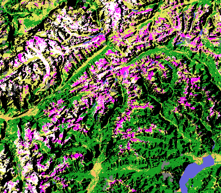
High Resolution Snow and Ice
High-Resolution Vegetation Phenology and Productivity parameters at pan-European level provide data about snow properties on land and ice occurrences in the hydrographic network.
Available High Resolution Snow parameters:
Fractional Snow Cover. The Fractional Snow Cover product provides the snow fraction at the Top Of Canopy (FSCTOC) and On Ground (FSCOG).
Gap-filled Fractional Snow Cover. The daily cumulative Gap-filled Fractional Snow Cover (0- 100%) product provides a more complete fractional snow cover information by spatially and temporally aggregating the Fractional Snow Cover data.
Persistent Snow Area. Generated from the Fractional Snow Cover for each hydrological year, the Persistent Snow Area provides information about the yearly extent of persistent snow cover.
Wet/Dry Snow. The Wet/Dry Snow product is differentiating snow state conditions within the snow mask defined by the fractional snow cover at top of canopy.
SAR Wet Snow. This product provides information about the wet snow extent in high-mountain areas.
Available High Resolution Ice parameters:
River and Lake Ice Extent. Provides pixel-based NRT information about ice presence in European rivers and lakes as defined by the EU-Hydro database and is based on data from Sentinel-1 and Sentinel-2.
Aggregated River and Lake Ice Extent. Provides information about the presence of ice or snow, open water and other soil features like vegetation and bare soil on 10 km river segments and lakes. This spatially aggregated product is derived from the different River and Lake Ice Extent products.
The product suite is operational since September 2016 onwards.
The High-Resolution Snow and Ice product suite is part of the European Union’s Copernicus Land Monitoring Service.
Simple
Identification info
- Date (Publication)
- 2021-09-01
- Citation identifier
- copernicus_hrsi_s
- Citation identifier
- DAT-244-en
- Point of contact
-
Organisation Individual Electronic mail address Website Role Copernicus Land Monitoring Service
Custodian European Environment Agency
Publisher
- Spatial representation type
- Grid
- Spatial representation type
- Vector
Spatial resolution
Equivalent scale
- Denominator
- 50000
- Topic category
-
- Climatology, meteorology, atmosphere
- Environment
- Imagery base maps earth cover
Extent
))
))
))
Temporal extent
- Time period
- 2016-09-01
Temporal extent
- Time period
- 2016-09-01 2024-09-01
- Continents, countries, sea regions of the world.
-
-
EEA38 (from 2020)
-
United Kingdom
-
- EEA Management Plan
-
-
2020 3.6.7
-
- EEA topics
-
-
Land use
- Land use
-
- GEMET
-
-
ice
-
land cover
-
landscape alteration
-
monitoring
-
climate change impact
-
snow
-
land use
- snow
- landscape alteration
- climate change impact
- land cover
- monitoring
- ice
-
river
-
lake
-
- GEMET - INSPIRE themes, version 1.0
-
-
Land cover
- Land cover
-
- Temporal resolution
-
-
Irregular
-
Six days
-
Daily
-
Annually
-
Five days
-
Associated resource
- Association Type
- Is composed of
- Metadata Reference
Associated resource
- Association Type
- Is composed of
- Metadata Reference
Associated resource
- Association Type
- Is composed of
Associated resource
- Association Type
- Is composed of
Associated resource
- Association Type
- Is composed of
- Metadata Reference
Associated resource
- Association Type
- Is composed of
Associated resource
- Association Type
- Is composed of
- Metadata Reference
Associated resource
- Association Type
- Is composed of
Metadata
- Metadata identifier
- 45e60a9f-f08b-47a9-97b6-21805cf22940
- Language
- English
- Character encoding
- UTF8
- Contact
-
Organisation Individual Electronic mail address Website Role European Environment Agency
Point of contact
Type of resource
- Resource type
- Series
- Metadata linkage
-
https://sdi.eea.europa.eu/catalogue/srv/api/records/45e60a9f-f08b-47a9-97b6-21805cf22940
- Date info (Creation)
- 2023-01-06T10:24:21.179Z
- Date info (Revision)
- 2026-01-07T09:56:21.670107Z
Metadata standard
- Title
-
ISO 19115-3:2018
- Edition
-
1.0
),POLYGON((44%2034,44%2066,-26%2066,-26%2034,44%2034)),POLYGON((46%2034,46%2072,-26%2072,-26%2034,46%2034))))