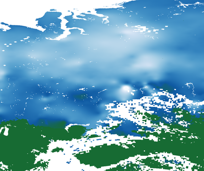
Snow Water Equivalent 2006-2024 (raster 5 km), northern hemisphere, daily - version 1
Snow Water Equivalent products describe the equivalent amount of liquid water stored in the snow pack. It indicates the water column that would theoretically result should the whole snow pack melt instantaneously and is defined as product between the snow layer’s depth and density.
Information about snow water equivalent is needed in applications such as flood forecasting, controlling the water level of power plant reservoirs, planning for forestry and crop irrigation and as input and control variable for many environment research purposes, including climate change research.
Simple
Identification info
- Date (Creation)
- 2018-01-01
- Date (Publication)
- 2018-01-01
- Edition
-
1
- Edition date
- 2023-09-25T00:00:00
- Citation identifier
- clms_global_swe_5km_v1_daily
Identifier
- Other citation details
-
https://land.copernicus.eu/en/products/snow/snow-water-equivalent-v1-0-5km
- Purpose
-
This product is first designed to fit the requirements of the Global component of Land Service of the Copernicus programme. It can be also useful for all applications related to snow cover and the environment monitoring in general.
- Credit
-
SWE products are generated by the land service of Copernicus, the Earth Observation programme of the European Commission. The research leading to the current version of the product has received funding from various European Commission Research and European Space Agency Technical Development programs. The product has been developed by Finnish Meteorological Institute.
- Point of contact
-
Organisation Individual Electronic mail address Website Role European Commission
Owner Copernicus Land Monitoring Service
Custodian European Commission's Joint Research Centre
Publisher Copernicus Land Monitoring Service helpdesk
Point of contact
- Spatial representation type
- Grid
Spatial resolution
- Spatial resolution
- 0.05 http://standards.iso.org/ittf/PubliclyAvailableStandards/ISO_19139_Schemas/resources/uom/ML_gmxUom.xml#deg
- Topic category
-
- Environment
- Geoscientific information
Extent
))
Extent
Temporal extent
- Time period
- 1 day composite dekad 2006-01-01 2024-06-30
- Maintenance and update frequency
- As needed
- mmi:updateScope
- Series
Resource format
- Title
-
netCDF
- Alternate title
-
Network Common Data Form
- Date
- Edition
-
4
- Theme
-
-
SSMIS
-
VIIRS
-
SNOW WATER EQUIVALENT
-
- Place
-
-
NHEMI
-
- Temporal
-
-
1 day composite
-
Resource constraints
- Access constraints
- Other restrictions
- Other constraints
- no limitations to public access
Resource constraints
- Use constraints
- Other restrictions
- Other constraints
-
The Copernicus component is governed by Regulation (EU) No 2021/696 of the European Parliament and of the Council of 28 April 2021 establishing the Union Space Programme and the European Union Agency for the Space Programme and repealing Regulations (EU) No 912/2010, (EU) No 1285/2013 and (EU) No 377/2014 and Decision No 541/2014/EU. Within the Copernicus component, a portfolio of land monitoring activities has been delegated by the European Union to the European Environment Agency (EEA) and the DG Joint Research Centre of the European Commission.
The Copernicus land monitoring products and services are made available on a principle of full, open and free access, as established by the Commission Delegated Regulation (EU) No 1159/2013 of 12 July 2013.
Free, full and open access to the products and services of the Copernicus Land Monitoring Service is made on the conditions that:
1. When distributing or communicating Copernicus Land Monitoring Service products and services (data, software scripts, web services, user and methodological documentation and similar) to the public, users shall inform the public of the source of these products and services.
2. Where the Copernicus Land Monitoring Service products and services have been adapted or modified by the user, the user shall clearly state this.
3. Users shall make sure not to convey the impression to the public that the user's activities are officially endorsed by the European Union.
- Language
- English
- Character encoding
- UTF8
Distribution Information
- Distribution format
-
-
netCDF
-
- Units of distribution
-
Per product
- OnLine resource
-
OGC WMTS
- OnLine resource
-
Copernicus Data Space Ecosystem download services
- Units of distribution
-
Per product
- OnLine resource
-
Copernicus Browser
Data quality info
- Hierarchy level
- Dataset
Report
Result
- Title
-
Validation results conform CEOS LPV guidelines
- Date (Publication)
- 2010-12-01
- Pass
- 1
Report
Result
- Date (Publication)
- 2010-12-08
- Explanation
-
This data set is conformant with the INSPIRE Implementing Rules for the interoperability of spatial data sets and services
- Pass
- true
Report
Result
- Title
- INSPIRE Data Specification on orthoimagery - Guidelines
- Date (Publication)
- 2010-04-26
- Explanation
-
See the referenced specification
- Pass
- true
Resource lineage
- Statement
-
The input data are the daily passive microwave observations by the SSMIS or VIIRS sensor.
- Hierarchy level
- Dataset
Spatial representation info
- Number of dimensions
- 2
- Cell geometry
- Area
- Transformation parameter availability
- false
- Check point availability
- true
- Check point description
-
Upperleft corner tiepoint
- Description
- Upperleft corner tiepoint
- Identifier
- upperLeftTiePoint
- Name
- Tie Point in upper left corner
- Pixel orientation code
-
Reference System Information
Reference System Information
- Code
- EPSG:4326
- Maintenance and update frequency
- As needed
Metadata
- Metadata identifier
- 58ca9f01-a526-418d-8862-b4be43ef4738
- Language
- English
- Character encoding
- UTF8
- Contact
-
Organisation Individual Electronic mail address Website Role Copernicus Land Monitoring Service
Point of contact
Type of resource
- Resource type
- Dataset
- Metadata linkage
-
https://sdi.eea.europa.eu/catalogue/srv/api/records/58ca9f01-a526-418d-8862-b4be43ef4738
- Date info (Creation)
- 2024-12-17T06:50:29.091476Z
- Date info (Revision)
- 2025-10-09T10:51:51.244538Z
Metadata standard
- Title
-
ISO 19115/19139
- Edition
-
1.0
Overviews
Spatial extent
)))
Provided by
