 EEA geospatial data catalogue
Water and Ice Cover S1&S2 2016-present (raster 20 m), Europe, daily
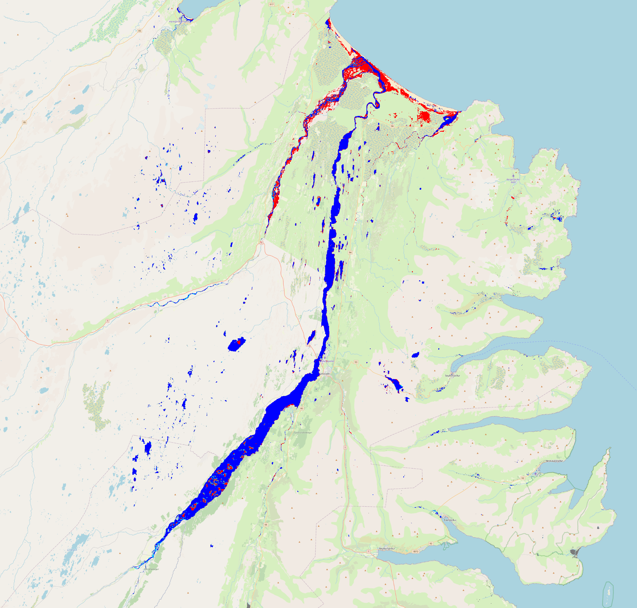
The Sentinel-1 & Sentinel-2 Water and Ice Cover (WIC S1+S2) product is generated in near real-time at European scale. It combines ice and water extent information derived from radar data from the Sentinel-1 constellation (WIC S1), and from optical data from the Sentinel-2 constellation (WIC S2). The WICS1+S2 product is processed when both WIC S1 and WIC S2 data are available on the same day. It provides the water and ice extent on water bodies (rivers and lakes), at a spatial resolution of 20 m x 20 m.
WIC S1+S2 is one of the products of the pan-European High-Resolution Water Snow & Ice portfolio (HR-WSI), which are provided at high spatial resolution from the Sentinel-2 and Sentinel-1 constellations data from September 1, 2016 onwards.
The WIC S1+S2 product is distributed in raster files covering an area of 110 km by 110 km with a pixel size of 20 m by 20 m in UTM/WGS84 projection, which corresponds to the Sentinel-2 input L1C product tile. Each product is composed of separate files corresponding to the different layers of the product, and another metadata file."
Simple
Identification info
- Date (Publication)
- 2025-03-05
- Edition
-
01.00
- Citation identifier
- copernicus_r_utm-wgs84_20_m_wics1s2_p_2016-now_v01_r00
- Citation identifier
- da67c24d-a8b3-4b43-a321-aedf9e5f0c83
Identifier
- Spatial representation type
- Grid
Spatial resolution
- Spatial resolution
- 20 m
- Topic category
-
- Environment
Extent
Temporal extent
- Time period
- 2025-03-05
Extent
))
- Maintenance and update frequency
- Continual
- Continents, countries, sea regions of the world.
-
-
United Kingdom
-
EEA38 (from 2020)
-
- Temporal resolution
-
-
Irregular
-
Resource constraints
- Access constraints
- Other restrictions
- Other constraints
- no limitations to public access
Resource constraints
- Use constraints
- Other restrictions
- Other constraints
-
The Copernicus component is governed by Regulation (EU) No 2021/696 of the European Parliament and of the Council of 28 April 2021 establishing the Union Space Programme and the European Union Agency for the Space Programme and repealing Regulations (EU) No 912/2010, (EU) No 1285/2013 and (EU) No 377/2014 and Decision No 541/2014/EU. Within the Copernicus component, a portfolio of land monitoring activities has been delegated by the European Union to the European Environment Agency (EEA) and the DG Joint Research Centre of the European Commission.
The Copernicus land monitoring products and services are made available on a principle of full, open and free access, as established by the Commission Delegated Regulation (EU) No 1159/2013 of 12 July 2013.
Free, full and open access to the products and services of the Copernicus Land Monitoring Service is made on the conditions that:
1. When distributing or communicating Copernicus Land Monitoring Service products and services (data, software scripts, web services, user and methodological documentation and similar) to the public, users shall inform the public of the source of these products and services.
2. Where the Copernicus Land Monitoring Service products and services have been adapted or modified by the user, the user shall clearly state this.
3. Users shall make sure not to convey the impression to the public that the user's activities are officially endorsed by the European Union.
- Language
- English
- Character encoding
- UTF8
Data quality info
- Hierarchy level
- Dataset
Report
Result
- Date (Publication)
- 2010-12-08
- Explanation
-
See the referenced specification
Resource lineage
- Statement
-
Input data are the Sentinel-1 and Sentinel-2 data as well as High Resolution Water Snow and Ice - Water/Ice cover products (WIC S1 and WIC S2), generated during the period covered by the WCD product.
- Hierarchy level
- Dataset
Reference System Information
Reference System Information
- Code
- EPSG:32625
Reference System Information
Reference System Information
- Code
- EPSG:32626
Reference System Information
Reference System Information
- Code
- EPSG:32627
Reference System Information
Reference System Information
- Code
- EPSG:32628
Reference System Information
Reference System Information
- Code
- EPSG:32629
Reference System Information
Reference System Information
- Code
- EPSG:32630
Reference System Information
Reference System Information
- Code
- EPSG:32631
Reference System Information
Reference System Information
- Code
- EPSG:32632
Reference System Information
Reference System Information
- Code
- EPSG:32633
Reference System Information
Reference System Information
- Code
- EPSG:32634
Reference System Information
Reference System Information
- Code
- EPSG:32635
Reference System Information
Reference System Information
- Code
- EPSG:32636
Reference System Information
Reference System Information
- Code
- EPSG:32637
Reference System Information
Reference System Information
- Code
- EPSG:32638
- Maintenance and update frequency
Metadata
- Metadata identifier
- 668f4071-5d18-48dc-9034-9680a2aea717
- Language
- English
- Character encoding
- UTF8
- Contact
-
Organisation Individual Electronic mail address Website Role European Environment Agency
Point of contact
Type of resource
- Resource type
- Dataset
- Date info (Creation)
- 2024-12-04T15:07:33.574069Z
- Date info (Revision)
- 2026-03-04T09:50:13.897367Z
Metadata standard
- Title
-
ISO 19115/19139
- Edition
-
1.0
)))