 EEA geospatial data catalogue
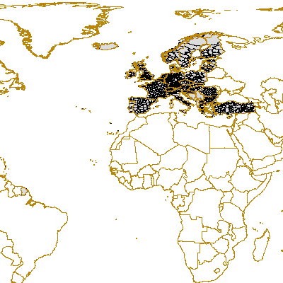
NUTS 2006 plus Balkan Countries
The 'GISCO NUTS 2006' dataset represents the NUTS regions by means of region, arc and point topology. The NUTS geographical information is completed by attribute tables and a set of cartographic help lines to better visualise multipart polygonal regions. The NUTS nomenclature is a hierarchical classification of statistical regions defined by Eurostat. The NUTS classification subdivides the EU economic territory into 3 statistical levels. The Regulation (EC) No 1059/2003 of the European Parliament and of the Council on the establishment of a common classification of territorial units for statistics (NUTS) was enforced the 11 July 2003. This regulation provided the NUTS classification with a legal background. Since then, 12 new countries joined the European Union. The NUTS regulation was officially enforced in these 12 countries the day of their accession to the EU. A non official NUTS-like classification has been defined for the EFTA countries, Croatia and Türkiye. For further information about the NUTS classification please check the RAMON Eurostat site at http://ec.europa.eu/comm/eurostat/ramon/nuts/home_regions_en.html At present, six scale ranges (100K, 1M, 3M, 10M and 20M, 60M) are maintained in the GISCO geodatabase. The polygon and boundary classes delineate the regions while the points provide a label for each region. Associated tables contain basic information such as the region's name. This feature class represents the polygon geometry of the 1:100.000 scale level of the NUTS regions. This shapefile was modified by the ETC-LUSI with the purpose of including this dataset into the LEAC System.
Simple
- Date (Creation)
- 2009-08-05
- Citation identifier
- eea_v_4258_100_k_nutsx_2006
- Status
- Superseded
- Point of contact
-
Organisation name Individual name Electronic mail address Website Role European Environment Agency
http://www.eea.europa.eu Point of contact European Environment Agency
Custodian
-
GEMET - INSPIRE themes, version 1.0
-
-
Statistical units
-
- Keywords
-
- Keywords
-
- Use limitation
-
EEA standard re-use policy: unless otherwise indicated, re-use of content on the EEA website for commercial or non-commercial purposes is permitted free of charge, provided that the source is acknowledged ( http://www.eea.europa.eu/legal/copyright). Copyright holder: European Environment Agency (EEA).
- Access constraints
- Other restrictions
- Other constraints
- no limitations to public access
- Spatial representation type
- Vector
- Denominator
- 100000
- Language of dataset
- English
- Character set
- UTF8
- Topic category
-
- Environment
- Geoscientific information
))
- Begin date
- 2006-01-01
- End date
- 2006-12-31
- Reference system identifier
- OGP Surveying & Positioning Committee / urn:ogc:def:crs:EPSG:7.1:4258
- Distribution format
-
- SHP ( )
OnLine resource
- Hierarchy level
- Dataset
Conformance result
- Title
-
Commission Regulation (EU) No 1089/2010 of 23 November 2010 implementing Directive 2007/2/EC of the European Parliament and of the Council as regards interoperability of spatial data sets and services
- Date (Publication)
- 2010-12-08
- Explanation
-
See the referenced specification
- Statement
-
Input Data from GISCO, NUTS 2006 version 010210, in particular the polygon version NUTS_RG_100K_2006 together with NUTS_AT_2006 where all the definitions are stored. The dataset was modified in order to include this information into the LEAC System. Country boundaries for the Balkan countries were extracted from the previous version of LEAC NUTS 2003 (nuts_balkan_countries) and included in this new version. Furthermore other changes were made in order to complete the dataset coverage with islands, lakes, etc. The final dbf table includes all the relationships among different NUTS levels as well as a combination of NUTS 0 2 and 3 called NUTS X.
process steps:
-Data was disaggregated by the field: "STAT_LEVL_CODE" into Country, NUTS 1, NUTS 2, NUTS 3. -Intersection of the four different layers: NUTS 0, 1, 2 and 3, in order to have all the definitions and relationships in one table.
-Generation of NUTS Definition Tables for NUTS according to the previous definition tables for 2003 used in LEAC cubes.
Some inconsistencies were found in the original file so they were fixed using the geometries from NUTS 2003 (nuts_balkan_countries). -Some isles were included: Man Island, Faroe Islands, -Some countries were missing or they were part of another countries such as: Monaco (It was included in France territory), San Marino (no data), Vatican City (no data), Andorra (no data), all these errors were corrected. - Boundaries for Balkan countries: Bosnia & Herzegovina, Serbia, Albania, Montenegro, Macedonia, Kosovo (UNSCR 1244/99), were extracted from "nuts_balkan_countries.shp". - Lakes were extracted from NUTS_BN_100K_2006 Polyline. To complete the dataset missing lakes were extracted from "nuts_balkan_countries.shp" and included in the final version.
Metadata
- File identifier
- 84e3a274-beff-40c1-bb40-c97afb8473d6 XML
- Metadata language
- English
- Character set
- UTF8
- Hierarchy level
- Dataset
- Date stamp
- 2020-07-10T17:40:50
- Metadata standard name
-
ISO 19115/19139
- Metadata standard version
-
1.0
- Metadata author
-
Organisation name Individual name Electronic mail address Website Role European Environment Agency
Point of contact
)))