 EEA geospatial data catalogue
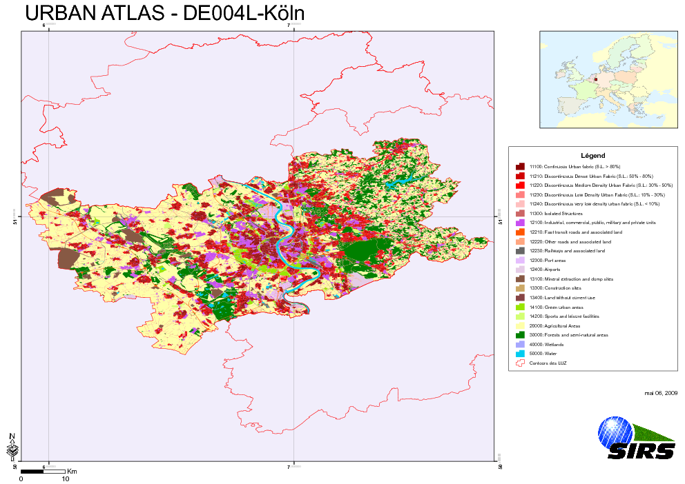
Urban Atlas - Germany - Cologne (Köln)
The Urban Atlas is providing pan-European comparable land use and land cover data for Large Urban Zones with more than 100.000 inhabitants as defined by the Urban Audit. Urban Atlas' mission is to provide high-resolution hotspot mapping of changes in urban spaces and indicators for users such as city governments, the European Environment Agency (EEA) and European Commission departments.
Simple
- Date (Publication)
- 2010-05-28
- Date (Creation)
- 2010-05-28
- Citation identifier
- regio_v_32632_10_k_ua-de004l_p_2006_v01_r00
- Status
- Obsolete
- Point of contact
-
Organisation name Individual name Electronic mail address Website Role European Environment Agency
http://www.eea.europa.eu Point of contact
- EEA topics
-
-
Sustainability solutions
-
Land use
-
-
GEMET - INSPIRE themes, version 1.0
-
-
Land use
-
-
GEMET
-
-
urban area
-
land use
-
- Keywords
-
- Keywords
-
- Place
-
-
Germany
-
Cologne
-
- Use limitation
-
EEA standard re-use policy: unless otherwise indicated, re-use of content on the EEA website for commercial or non-commercial purposes is permitted free of charge, provided that the source is acknowledged ( http://www.eea.europa.eu/legal/copyright). Copyright holder: Directorate-General Enterprise and Industry.
- Access constraints
- Other restrictions
- Other constraints
- no limitations to public access
- Spatial representation type
- Vector
- Denominator
- 10000
- Language of dataset
- English
- Character set
- UTF8
- Topic category
-
- Society
))
- Begin date
- 2006-07-14
- End date
- 2006-10-16
- Reference system identifier
- OGP Surveying & Positioning Committee / urn:ogc:def:crs:EPSG:7.1:32632
- Distribution format
-
- SHP ( )
- OnLine resource
-
Protocol Linkage Name EEA:FOLDERPATH
https://sdi.eea.europa.eu/webdav/datastore/public/regio_v_32632_10_k_ua-de004l_p_2006_v01_r00 EEA:DBPG
pg:gis_sdi/urban_atlas.de004l_koln WWW:URL
https://sdi.eea.europa.eu/data/88dcd632-e9ae-40a6-9279-2f535812aa56 Direct download
- Hierarchy level
- Dataset
Conformance result
- Title
-
Commission Regulation (EU) No 1089/2010 of 23 November 2010 implementing Directive 2007/2/EC of the European Parliament and of the Council as regards interoperability of spatial data sets and services
- Date (Publication)
- 2010-12-08
- Explanation
-
See the referenced specification
- Statement
-
Earth Observation (EO) Data used:
* Spot 5 2,50 m - 00182800014 (PS) (Date: 2006/07/14)
* Spot 5 2,50 m - 00182800024 (PS) (Date: 2006/10/16)
Metadata
- File identifier
- 88dcd632-e9ae-40a6-9279-2f535812aa56 XML
- Metadata language
- English
- Character set
- UTF8
- Hierarchy level
- Dataset
- Date stamp
- 2020-12-03T12:03:39
- Metadata standard name
-
ISO 19115/19139
- Metadata standard version
-
1.0
- Metadata author
-
Organisation name Individual name Electronic mail address Website Role European Environment Agency
Point of contact
)))