 EEA geospatial data catalogue
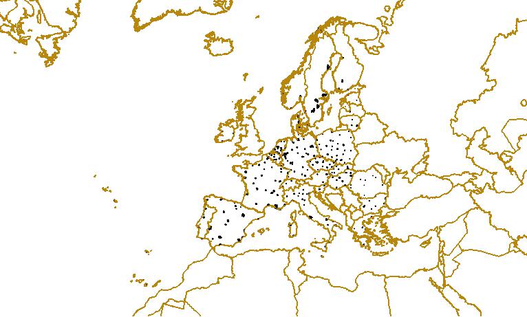
GISCO - Urban Audit 2004, Nov. 2009
When using this data set, it should be bibliographically referred to as 'Urban Audit, 2004'. The Urban Audit (UA) provides European urban statistics for a representative sample of large and medium-sized cities across 30 European countries. It enables an assessment of the state of individual EU cities and provides access to comparative information from other EU cities. This spatial dataset will support the study and dissemination of the UA data. It allows the visualisation of participating cities at three conceptual levels: - UA City - the core city, using an administrative definition - UA City Kernel - a concept introduced to improve comparability between large cities - Larger Urban Zone (LUZ) - approximating the functional urban region In addition, this spatial dataset allows visualisation of a 285 participating cities at two hierarchical sublevels to analyse the disparities within cities: - Sub City Districts level 1 (SCD L1) - Sub City Districts level 2 (SCD L2) The extent of this dataset is the EU 27 (2007) plus Croatia (HR), Norway (NO) and Switzerland (CH). The URAU_2004 dataset contains a polygonal feature class for UA Cities, UA City Kernels and Large Urban Zones, derived from the geometry of the GISCO COMM_2004 dataset (based on EuroBoundary Map 2004). Polygonal feature classes for Sub City Districts are derived from the geometry of the GISCO COMM_2004 dataset (based on EuroBoundary Map 2004) or spatial data supplied by URAU delegates which has been made coincident with UA City geometry. A generalised version of each feature class allows for visualisation at the scale of 1:3 Million. UA Cities are also represented by a point topology that are derived from and synchronised with the GISCO STTL_V3 dataset of European Settlements. The UA city points are, when possible, synchronised to an Urban Fabric class in Corine Land Cover 2000.
Simple
Identification info
- Date (Creation)
- 2009-11-02
- Edition
-
2009
- Citation identifier
- eurostat_v_4258_3_mio_urau_p_2004_V01_r00
- Status
- Superseded
- Spatial representation type
- Vector
Spatial resolution
Equivalent scale
- Denominator
- 3000000
- Topic category
-
- Environment
- Geoscientific information
Extent
))
Extent
Temporal extent
- Time period
- 2003-01-01 2004-12-31
- Maintenance and update frequency
- Irregular
- GEMET - INSPIRE themes, version 1.0
-
-
Area management/restriction/regulation zones and reporting units
-
- EEA topics
-
-
Water
-
Resource constraints
- Use limitation
-
License
Resource constraints
- Access constraints
- copyright
- Use constraints
- license
- Language
- English
- Character encoding
- UTF8
Data quality info
- Hierarchy level
- Dataset
Report
Result
- Title
- Commission Regulation (EU) No 1089/2010 of 23 November 2010 implementing Directive 2007/2/EC of the European Parliament and of the Council as regards interoperability of spatial data sets and services
- Date (Publication)
- 2010-12-08
- Explanation
-
See the referenced specification
Resource lineage
- Statement
-
The third Urban Audit exercise was launched in 2006. The collected data is referenced to 2004. It is managed by the Directorate General for Regional Policy in collaboration with EUROSTAT. The URAU_2004 polygonal geometry for UA Cities, UA City Kernels and Large Urban Zones was derived from the GISCO Communes 2004 regional feature class. Information assigning membership of each EBM 2004 commune to each of the 3 UA conceptual levels was provided at the Country level. The URAU_2004 polygonal geometry for Sub City Districts was either derived from the GISCO Communes 2004 regional feature class (where information assigning membership of each EBM 2004 commune to hierarchical sublevels levels was provided at the Country level), or derived from geometry supplied by URAU delegates which was made coincident with UA City geometry. Generalised versions were created for display at a scale of 1:3 Million. The point geometry of the Urban Audit Cities was based on the GISCO STTL_V3 dataset of European Settlements. Points were created in 17 cases where a UA City could not be matched to a Settlement in GISCO STTL_V3 dataset.
Creation of City, Kernel and LUZ feature classes: Country files listing UA status (City, Kernel and LUZ codes) of each EBM 2004 commune were joined to the geometry of the GISCO COMM_2004 regions. This was dissolved by each UA code to give the multipart regions for each UA level. Attributes were appended to each feature class by joining pre-prepared attribute tables. Creation of UA SCD2 feature classes based on communes 2004 geometry: For countries IE, MT and PT, country files listing the SCD L2 status of each EBM 2004 commune were joined to the geometry of the GISCO COMM_2004 regions. This was dissolved by each SCD L2 code to give multipart regions. Further subdivision of SCD L2 regions in the country of PT were made based on URAU_2001 geometry. Creation of UA SCD2 feature classes based on provided digital maps: For the remaining UA Cities for which SCD geometry is available, SCD L2 regions were derived from GIS files supplied by URAU delegates in various projections, coordinate systems and GIS formats. The SCD L2 regions were converted, projected and had geographic transformations applied where necessary. Some SCD L2 geometry had small manual shifts applied where the exact geographic transformation could not be defined. In the country RO, the outer SCD2 regions are not coincident with GISCO COMM_2004, and were fitted using aerial imagery. The outer SCD L2 boundaries were made coincident with UA City geometry. In the country BE, some internal boundaries were also made coincident with GISCO COMM_2004 geometry. Creation of UA SCD1: SCD attributes were appended to the SCD L2 feature class by joining pre-prepared attribute tables. SCD L1 geometry was created by dissolving SCD L2 boundaries using attributes in the supplied tables. Generalisation of polygonal feature classes to 1:3 million scale: The five polygonal feature classes were generalised for display at a scale of 1:3 Million. The geometries were combined prior to generalisation using a Union, so that boundaries shared between feature classes would also share the same simplified form. Polygons below 2.25km2 were eliminated by merging into the neighbouring polygon sharing the longest border, or deleted (for small islands). At least one feature was retained for each unique City, SCD L1, SCD L2, Kernel and LUZ. The simplification used the Bend Simplify option of the Simplify Polygon tool in ArcGIS 9.3, with a reference baseline of 1500m. Synchronisation of city points with STTL_V3: UA City points were derived by matching City regions to the GISCO Settlement Version 3 dataset (STTL_V3) based on proximity and name-matches. All except 17 UA Cities were matched, and STTL_V3 codes were retained as a UA City attribute. In several cases the STTL_V3 and UA City points were located outside the UA City regions (original or generalised). They were moved so that the point falls inside the RG, while still respecting the requirements for STTL_V3 points. Attribution of COMM_2004: The Urban Audit status of each commune was recorded by appending the City, Kernel and LUZ codes to the COMM_2004_AT attribute table.
- Hierarchy level
- Dataset
Reference System Information
- Reference system identifier
- OGP Surveying & Positioning Committee/urn:ogc:def:crs:EPSG:7.1:4258
Metadata
- Metadata identifier
- bb5ab4fd-add7-4849-b89f-22d42a198932
- Language
- English
- Character encoding
- UTF8
- Contact
-
Organisation Individual Electronic mail address Website Role European Environment Agency
Point of contact
Type of resource
- Resource type
- Dataset
- Metadata linkage
-
https://sdi.eea.europa.eu/catalogue/srv/api/records/bb5ab4fd-add7-4849-b89f-22d42a198932
- Date info (Creation)
- 2010-10-11T17:39:16Z
- Date info (Revision)
- 2025-10-09T11:11:28.411743Z
Metadata standard
- Title
-
ISO 19115/19139
- Edition
-
1.0
)))