 EEA geospatial data catalogue
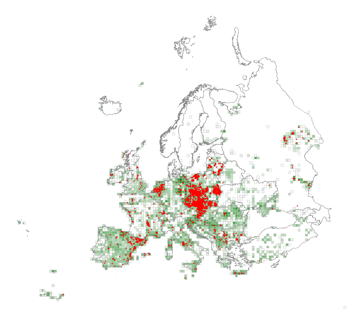
EUNIS vegetated man-made habitat types, distribution based on vegetation plot data - version 1, Nov. 2021
This metadata corresponds to the EUNIS Vegetated man-made habitats types, distribution based on vegetation plot data dataset.
Anthropogenic habitats which are dominated by vegetation and usually subject to regular management but also arising from recent abandonment of previously cultivated ground. This includes areas cultivated for crops, orchards and grasslands such as lawns and sports fields which are a result of reseeding and often heavily fertilised together with planted and managed forests and other anthropogenic habitats with trees such as avenues. Non vegetated anthropogenic habitats are Constructed, industrial and other artificial habitats (Y).
The verified vegetated man-made habitat samples used are derived from the Braun-Blanquet database ( http://www.sci.muni.cz/botany/vegsci/braun_blanquet.php?lang=en) which is a centralised database of vegetation plots and comprises copies of national and regional databases using a unified taxonomic reference database. The geographic extent of the distribution data are all European countries except Armenia and Azerbaijan. The dataset is provided both in Geodatabase and Geopackage formats.
Simple
Identification info
-
Date (Publication)
- 2021-11-15
-
Date (Creation)
- 2019-03-01
-
Edition
-
01.00
-
Citation identifier
- eea_v_3035_10_mio_eunis-hab-v_p_1940-2020_v01_r00
-
Citation identifier
- DAT-137-en
Identifier
- Point of contact
-
Organisation Individual Electronic mail address Website Role European Environment Agency
Point of contactEuropean Environment Agency
Custodian
-
Spatial representation type
-
Vector
Spatial resolution
Equivalent scale
-
Denominator
- 10000000
-
Topic category
-
-
Biota
-
Extent
))
Extent
Temporal extent
-
Time period
- 1940-01-01 2017-12-31
-
Maintenance and update frequency
-
Not planned
- GEMET - INSPIRE themes, version 1.0
-
-
Habitats and biotopes
-
- GEMET
-
-
habitat
-
terrestrial ecosystem
-
natural area
-
- Continents, countries, sea regions of the world.
-
-
Russian Federation (European part)
-
Monaco
-
Ukraine
-
Moldova
-
Belarus
-
United Kingdom
-
San Marino
-
Georgia
-
EEA38 (from 2020)
-
Andorra
-
- EEA topics
- EEA Management Plan
-
-
2021 1.1.4
-
Resource constraints
-
Access constraints
-
Other restrictions
-
Other constraints
- no limitations to public access
Resource constraints
-
Use constraints
-
Other restrictions
-
Other constraints
-
License CC-BY 4.0 ( https://creativecommons.org/licenses/by/4.0/). Copyright holder: European Environment Agency (EEA).
-
Language
- English
Distribution Information
Data quality info
-
Hierarchy level
-
Dataset
Report
Result
-
Title
- Commission Regulation (EU) No 1089/2010 of 23 November 2010 implementing Directive 2007/2/EC of the European Parliament and of the Council as regards interoperability of spatial data sets and services
-
Date (Publication)
- 2010-12-08
-
Explanation
-
See the referenced specification
Resource lineage
-
Statement
-
The database compiled for the Braun-Blanquet project comprises various national and regional vegetation databases. The maintenance of these databases is in principle in the hands of the custodians. However, before uploading datasets into the Braun-Blanquet database a quality check is performed by WENR and Masaryk University. If possible, detected errors are corrected and reported back to the data provider. Attributes added to the distribution data are: YEAR (year of recording) and PRECISION (precision in meters, indicating how precise the location is indicated).
Supporting information on the methodology used to create the maps is provided with the dataset.
-
Hierarchy level
-
Dataset
Reference System Information
Reference System Information
-
Code
- EPSG:3035
Metadata
-
Metadata identifier
- e4351c92-690f-42cd-9cfa-f5e1c6516474
-
Language
- English
-
Character encoding
-
UTF8
- Contact
-
Organisation Individual Electronic mail address Website Role European Environment Agency
Point of contact
Type of resource
-
Resource type
-
Dataset
-
Date info (Creation)
- 2020-05-19T05:28:36Z
-
Date info (Revision)
- 2025-10-09T11:19:49.767018Z
Metadata standard
-
Title
-
ISO 19115-3:2018
-
Edition
-
1.0
)))