EEA geospatial data catalogue
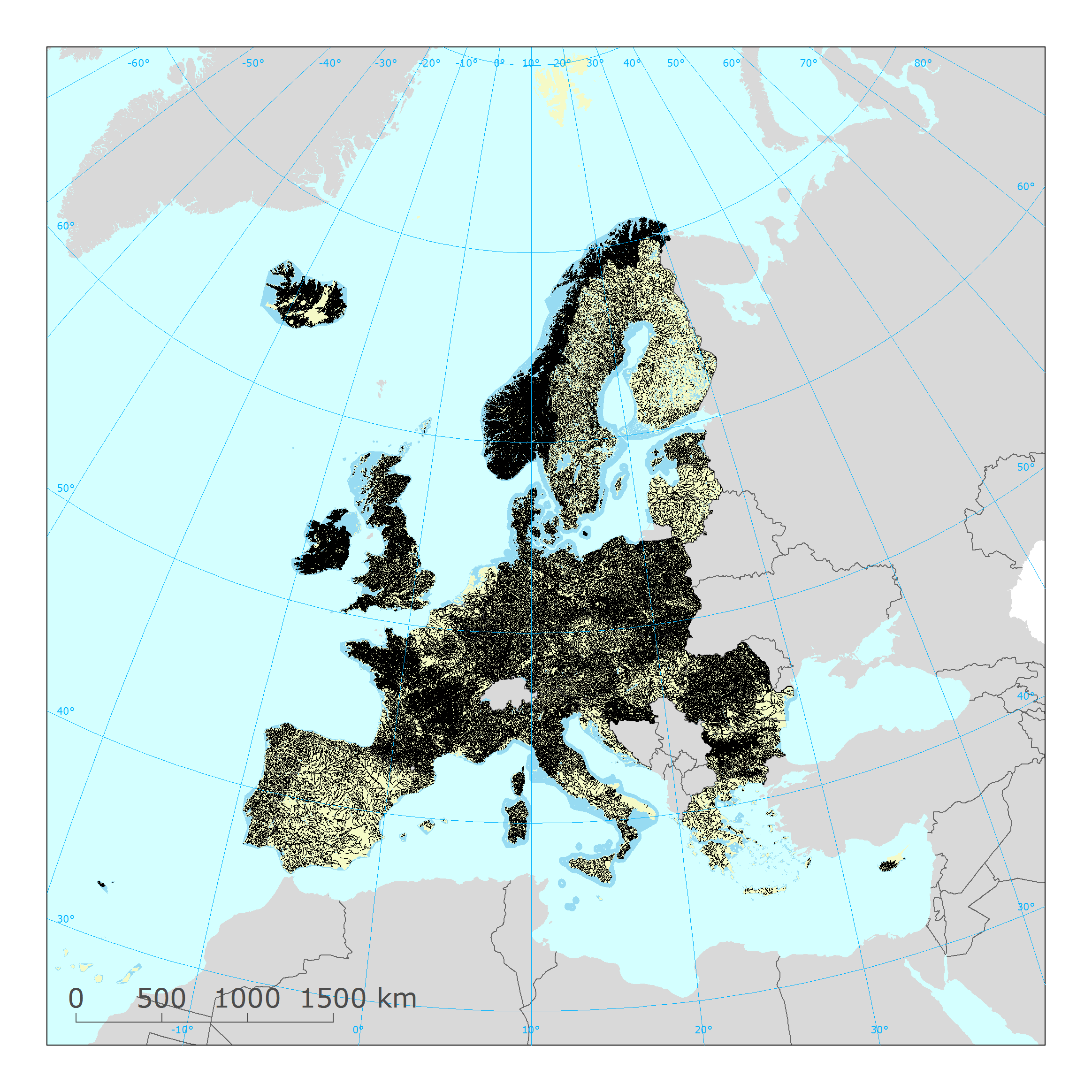
WISE WFD surface water bodies reported under Water Framework Directive 2016
The service contains information on the European surface water bodies delineated for the 2nd River Basin Management Plans (RBMP) under the Water Framework Directive (WFD).
The information was reported to the European Commission under the Water Framework Directive (WFD) reporting obligations.
The dataset compiles the available spatial data related to the 2nd RBMPs due in 2016 (hereafter WFD2016). See http://rod.eionet.europa.eu/obligations/715 for further information on the WFD2016 reporting.
Relevant concepts:
Surface water body: Body of surface water means a discrete and significant element of surface water such as a lake, a reservoir, a stream, river or canal, part of a stream, river or canal, a transitional water or a stretch of coastal water.
Surface water: Inland waters, except groundwater; transitional waters and coastal waters, except in respect of chemical status for which it shall also include territorial waters.
Inland water: All standing or flowing water on the surface of the land, and all groundwater on the landward side of the baseline from which the breadth of territorial waters is measured.
River: Body of inland water flowing for the most part on the surface of the land but which may flow underground for part of its course.
Lake: Body of standing inland surface water.
Transitional waters: Bodies of surface water in the vicinity of river mouths which are partly saline in character as a result of their proximity to coastal waters but which are substantially influenced by freshwater flows.
Coastal water: Surface water on the landward side of a line, every point of which is at a distance of one nautical mile on the seaward side from the nearest point of the baseline from which the breadth of territorial waters is measured, extending where appropriate up to the outer limit of transitional waters.
Territorial sea: The territorial waters, or territorial sea as defined by the 1982 United Nations Convention on the Law of the Sea, extend up to a limit not exceeding 12 nautical miles (22.2 km), measured from the baseline. The normal baseline is the low-water line along the coast.
Territorial waters [Operational definition. Not in WFD.]: Reporting unit. The zone between the limit of the coastal water bodies and the limit of the territorial sea, geometrically subdivided in Thiessen polygons according to the adjacent coastal sub-unit (or using any alternative delineation provided by the national competent authorities), and assigned to an adjacent sub-unit for the purpose of reporting the chemical status of the territorial waters under the Water Framework Directive.
Simple
Identification info
- Date (Publication)
- 2019-04-15
- Citation identifier
- eea_v_4326_250_k_wise-surface-water-bodies-wfd2016_service
- Status
- Obsolete
- Point of contact
-
Organisation Individual Electronic mail address Website Role European Environment Agency
Point of contact
- GEMET
-
-
inland water
-
Water Framework Directive
-
river
-
lake
-
surface water
-
water resources management
-
water (geographic)
-
coastal water
-
transitional waters
-
water
-
ecological status
-
water body
-
- GEMET - INSPIRE themes, version 1.0
-
-
Area management/restriction/regulation zones and reporting units
-
- Continents, countries, sea regions of the world.
-
-
Slovakia
-
Germany
-
Malta
-
Lithuania
-
Ireland
-
Spain
-
Netherlands
-
Greece
-
Cyprus
-
Luxembourg
-
Czechia
-
Denmark
-
Italy
-
Bulgaria
-
Estonia
-
Austria
-
Hungary
-
Romania
-
Finland
-
Poland
-
Sweden
-
Portugal
-
Iceland
-
Belgium
-
Croatia
-
United Kingdom
-
France
-
Norway
-
Latvia
-
Slovenia
-
- Spatial scope
-
-
European
-
- INSPIRE priority data set
-
-
Directive 2000/60/EC
-
Surface water bodies (Water Framework Directive)
-
Lakes (Water Framework Directive)
-
River network (Water Framework Directive)
-
Rivers (Water Framework Directive)
-
Coastal waters (Water Framework Directive)
-
Water bodies (Water Framework Directive)
-
Transitional waters (Water Framework Directive)
-
- EEA topics
-
-
Water
-
Resource constraints
- Access constraints
- Other restrictions
- Other constraints
- no limitations to public access
Resource constraints
- Use constraints
- Other restrictions
- Other constraints
-
No limitations in the use of this web service.
Data quality info
- Hierarchy level
- Dataset
Report
Result
- Date (Publication)
- 2010-12-08
- Explanation
-
See the referenced specification
Resource lineage
- Statement
-
For more information about the lineage of the datasets provided via this web service, please consult the metadata of the associated dataset.
- Hierarchy level
- Dataset
Reference System Information
Reference System Information
- Code
- EPSG:4326
Reference System Information
Reference System Information
- Code
- EPSG:3857
Reference System Information
Reference System Information
- Code
- EPSG:102100
Reference System Information
- Reference system identifier
- CRS:84
Metadata
- Metadata identifier
- 9f98d7f2-e685-4580-82cd-6996f75155cd
- Language
- English
- Character encoding
- UTF8
- Contact
-
Organisation Individual Electronic mail address Website Role European Environment Agency
Point of contact
Type of resource
- Resource type
- Dataset
- Metadata linkage
-
https://sdi.eea.europa.eu/catalogue/srv/api/records/9f98d7f2-e685-4580-82cd-6996f75155cd
- Date info (Creation)
- 2020-03-26T09:41:43Z
- Date info (Revision)
- 2025-10-09T11:28:27.685129Z
Metadata standard
- Title
-
ISO 19119/19139
- Edition
-
1.0