 EEA geospatial data catalogue
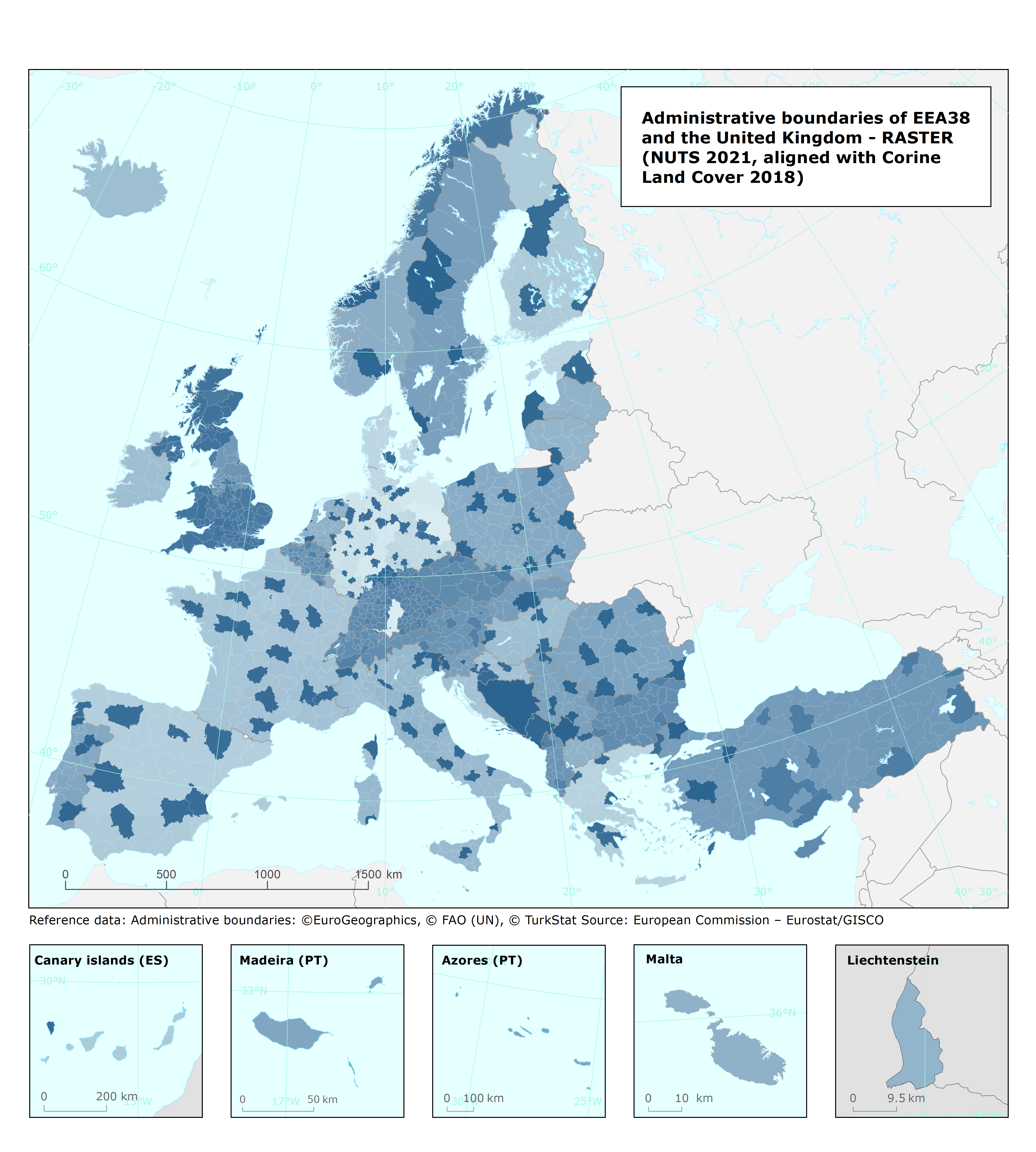
Administrative boundaries of EEA38 and the United Kingdom (NUTS 2021, aligned with Corine Land Cover 2018) raster version (100 m), Mar. 2022
This metadata refers to the dataset representing the administrative boundaries of the EEA38 member countries and the United Kingdom at various aggregation levels using the NUTS 2021 classification (Nomenclature of territorial units for statistics): country (NUTS0), NUTS1, NUTS2, and NUTS3 regions, plus some extra territories as Andorra, Monaco, San Marino, Vatican City.
The dataset has been created in raster format with a spatial resolution of 100m grid size, matching with the Corine Land Cover 2018 accounting layer to support spatial analysis and calculating statistics at country level for the European territory as needed by accounting activities such as Land and Ecosystem Accounting (LEAC).
This dataset is based on the Eurostat GISCO database (extracted in May 2021), in particular on the layer NUTS 2021 at 100:000 scale for the main countries complemented by part of additional layers as EEZ (Exclusive Economic Zone) 2021, and EuroGeographics' EuroBoundaryMap 2022 dataset.
The EEA-adapted metadata of the data sources, GISCO NUTS 2021 and EBM 2022, can be consulted in the EEA SDI data catalogue.The public metadata for NUTS 2021 released by Eurostat is available here: https://gisco-services.ec.europa.eu/distribution/v2/nuts/nuts-2021-metadata.xml. An introduction to the NUTS classification is available here: http://ec.europa.eu/eurostat/web/nuts/overview. More information about EuroBoundaryMap can be found here: https://eurogeographics.org/maps-for-europe/ebm/ .
Simple
Identification info
- Date (Creation)
- 2021-04-05
- Date (Publication)
- 2022-03-15
- Edition
-
01.00
- Citation identifier
- eea_r_3035_100_m_adm-boundaries-eea38-plus_p_2018-2020_v01_r00
- Point of contact
-
Organisation Individual Electronic mail address Website Role European Environment Agency
Point of contact European Environment Agency
Custodian
- Spatial representation type
- Grid
Spatial resolution
- Spatial resolution
- 100 m
- Topic category
-
- Environment
Extent
))
Temporal extent
- Time period
- 2018-01-01 2021-12-31
Extent
- Maintenance and update frequency
- As needed
- Continents, countries, sea regions of the world.
-
-
Monaco
-
San Marino
-
EEA38 (from 2020)
-
Andorra
-
Vatican
-
United Kingdom
-
Resource constraints
- Access constraints
- Other restrictions
- Other constraints
- no limitations to public access
Resource constraints
- Use constraints
- Other restrictions
- Other constraints
-
The European Environment Agency is authorized to distribute derived geographic data from EuroGeographics Administrative and Topographic spatial datasets and other derived products to third parties, if
The source is acknowledged, AND
The data is not used for commercial purpose, AND
The original geometry is generalised to the equivalent of a scale of 1:1.000.000 or smaller.
Acknowledgement notice to be supplied with derived geographic data and other derived products: For the administrative boundaries: © EuroGeographics, © FAO (UN), © TurkStat Source: European Commission – Eurostat/GISCO
- Language
- English
Distribution Information
- Distribution format
-
-
GeoTIFF
-
- OnLine resource
-
Direct download
Data quality info
- Hierarchy level
- Dataset
Report
Result
- Title
- Commission Regulation (EU) No 1089/2010 of 23 November 2010 implementing Directive 2007/2/EC of the European Parliament and of the Council as regards interoperability of spatial data sets and services
- Date (Publication)
- 2010-12-08
- Explanation
-
See the referenced specification
Resource lineage
- Statement
-
The EEA38+ dataset is a harmonized version of the administrative boundaries based on the official GISCO NUTS 2021 layer and rasterized at 100 m resolution to fully cover the extent of the CLC 2018 land mask (excluding class 523).
It covers all EEA38 member countries, plus extra NUTS regions, namely United Kingdom and Gibraltar, Andorra, San Marino, Monaco, and Vatican City. The dataset is based on the GISCO release May 2021 on the layer NUTS 100k for the main countries while extra countries (e.g. Bosnia and Montenegro) and the extra coastal regions are derived from parts of additional layers from the same database as the Exclusive Economic Zones (GISCO, 2021) and EuroBoundaryMap 2022 (with reference year 2020).
The dataset has been created to be used in EEA applications for performing spatial analysis and calculating statistics by European administrative boundaries.
The attribute table (attached as separate file: 'code table') provides two code standards for aggregating the NUTS by country level. Specifically, the field "ISO2" referrers to the ISO 3166-1 alpha-2 code [ https://en.wikipedia.org/wiki/ISO_3166-1_alpha-2], and the field "ESTAT" which refers to the Eurostat recommendations [https://ec.europa.eu/eurostat/statistics-explained/index.php?title=Tutorial:Country_codes_and_protocol_order#Codes.2C_names_and_protocol_order_of_European_Union_.28EU.29_Member_States].
The field “ADM_COUNTR” provides the full name of the country following the ESTAT code.
Finally, the attribute table presents a set of fields, one per each aggregated country code [ https://taskman.eionet.europa.eu/projects/public-docs/wiki/Country_codes] with a Boolean expression, '1' means that the region belongs to the country group, while '0' it does not .
The “TAA” field helps in differentiate pixels among "Land Area", "Inland Water", Coastal Water for valid EEA38 + UK coverage (to obtain the full CLC coverage), while "No Country", “buffer land” for those CLC pixels out of the EEA 38 member countries+UK coverage.
- Hierarchy level
- Dataset
Reference System Information
Reference System Information
- Code
- EPSG:3035
Metadata
- Metadata identifier
- 08c0e074-4a98-4545-bd85-f58fe3f74d82
- Language
- English
- Character encoding
- UTF8
- Contact
-
Organisation Individual Electronic mail address Website Role European Environment Agency
Point of contact
Type of resource
- Resource type
- Dataset
- Metadata linkage
-
https://sdi.eea.europa.eu/catalogue/srv/api/records/08c0e074-4a98-4545-bd85-f58fe3f74d82
- Date info (Creation)
- 2022-03-07T15:35:45.949Z
- Date info (Revision)
- 2025-10-09T10:35:28.39693Z
Metadata standard
- Title
-
ISO 19115/19139
- Edition
-
1.0
)))