 EEA geospatial data catalogue
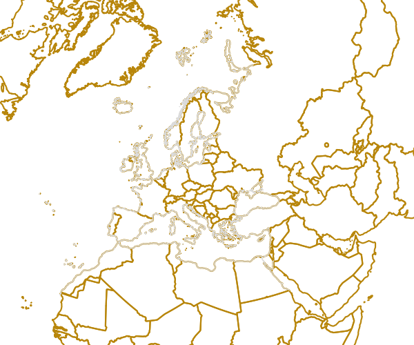
EEA coastline for analysis (raw) - version 1.0, Jun. 2013
The criteria for defining the coastline is the line separating water from land. The EEA coastline is a product derived from two sources: EUHYDRO [link not available - yet] and GSHHG [ http://www.soest.hawaii.edu/pwessel/gshhg/] A priority defined in the input data, first EUHYDRO geometry and, as auxiliary data, GSHHG dataset. The EUHYDRO do not cover the requirement for EEA coastline. The EUHYDRO gaps are in Iceland, Canarias, Madeira, Azores, small islands (not represented in EUDEM) and the northern of Black Sea. The creation process was focused on generating the coastline as line dataset and, later, as a secondary product, defining the polygon layer sea-land. The fundamental step into the workflow was the selection of sea features using a water mask polygon (value in EUHYDRO datasets = 255). The inland water bodies (freshwaters) are rejected by this criteria, except the water bodies connected, at least by one point, to the sea (it is the cases of some transitional water bodies). A few manual amendments to the dataset were necessary to meet requirements from EU Nature Directives, Water Framework Directive and Marine Strategy Framework Directive. This dataset consists of a series of contiguous coastal segments. The source of each of them (EUDEM, GSHHG...) is available as attribute.
Simple
Identification info
- Date (Creation)
- 2013-06-28
- Edition
-
1.0
- Citation identifier
- eea_v_3035_100_k_coastline-raw_1995-2012_p_v01_r00
- Status
- Superseded
- Point of contact
-
Organisation Individual Electronic mail address Website Role European Environment Agency
Point of contact European Environment Agency
Custodian
- Spatial representation type
- Vector
Spatial resolution
Equivalent scale
- Denominator
- 100000
- Topic category
-
- Oceans
- Elevation
Extent
))
Extent
Temporal extent
- Time period
- 1995-08-01 2012-12-31
- GEMET - INSPIRE themes, version 1.0
-
-
Sea regions
-
- GEMET
-
-
coast
-
- Place
-
-
Europe
-
Resource constraints
- Use constraints
- Other restrictions
- Other constraints
-
License CC-BY 4.0 ( https://creativecommons.org/licenses/by/4.0/).
Resource constraints
- Access constraints
- Other restrictions
- Other constraints
- no limitations to public access
- Language
- English
- Character encoding
- UTF8
Data quality info
- Hierarchy level
- Dataset
Report
Result
- Title
-
Commission Regulation (EU) No 1089/2010 of 23 November 2010 implementing Directive 2007/2/EC of the European Parliament and of the Council as regards interoperability of spatial data sets and services
- Date (Publication)
- 2010-12-08
- Explanation
-
See the referenced specification
Resource lineage
- Statement
-
The criteria for defining the coastline is the line separating water from land. The EEA coastline is a product derived from two sources: EUHYDRO [link not available - yet] and GSHHG [ http://www.soest.hawaii.edu/pwessel/gshhg/] A priority defined in the input data, first EUHYDRO geometry and, as auxiliary data, GSHHG dataset. The EUHYDRO do not cover the required extension of EEA coastline. The EUHYDRO gaps are in Iceland, Canarias, Madeira, Azores, small islands (not represented in EUDEM) and the northern of Black Sea. For that reason the the GSHHG dataset is an input for the process which allow to populate the EUHYDRO shapefile.
The creation process was focused on generate the coastline as line datasets and, later, as secondary product, defining the polygon layer sea-land. Thank reiterative processes based on conversion (from water mask of EUHYDRO to polygon), selection, dissolving and conversion (to line) tools, it was possible to obtain a continuous and homogeneous coastline. The fundamental step into the workflow was the selection of sea features using the water mask polygon (with 255 value into EUHYDRO datasets). The inland water bodies (freshwaters) are rejected by this criteria, except the water bodies connected, at least by one point, to the sea (it is the cases of some transitional water bodies).
The patchwork coastline has been subjected to quality assessment based on evaluate the degree of coverage and topological errors.
- Hierarchy level
- Dataset
Reference System Information
Reference System Information
- Code
- EPSG:3035
Metadata
- Metadata identifier
- 47142840-45c7-4e23-a497-c6fc4fd84a48
- Language
- English
- Character encoding
- UTF8
- Contact
-
Organisation Individual Electronic mail address Website Role European Environment Agency
Point of contact
Type of resource
- Resource type
- Dataset
- Metadata linkage
-
https://sdi.eea.europa.eu/catalogue/srv/api/records/47142840-45c7-4e23-a497-c6fc4fd84a48
- Date info (Creation)
- 2013-07-02T14:12:09Z
- Date info (Revision)
- 2025-10-09T10:48:11.053822Z
Metadata standard
- Title
-
ISO 19115/19139
- Edition
-
1.0
)))