 EEA geospatial data catalogue
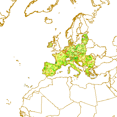
Corine Land Cover 1990 (raster 100m) - version 15, Aug. 2011
With the help of CLC data it is possible to provide support for protecting ecosystems, halting the loss of biological diversity, tracking the impacts of climate change, assessing developments in agriculture and implementing the EU Water Framework Directive. CLC data is an important data set for the implementation of key priority areas of the Sixth Environment Action Programme of the European Community. CLC data can show, for instance, where fragmentation of the landscape by roads and other infrastructure is worsening and thus increasing the risk that ecosystems can no longer connect with each other, putting the survival of their flora and fauna in danger. In the agricultural field CLC data can highlight where major structural changes are continuing or intensifying, such as the conversion of pasture to arable land, expansion or reduction in the area of fallow land and land taken out of production ('set aside'), or the abandonment of farming altogether. CLC serve as input to the EC 'Inspire' (INfrastructure for SPatial InfoRmation in Europe - http://inspire.jrc.it) initiative. This initiative intends to trigger the creation of a European spatial information infrastructure that delivers to the users integrated spatial information services. CLC programme is also a contribution to the Global Monitoring for Environment and Security (GMES http://gmes.info) initiative, run by the European Commission and the European Space Agency, to provide environmental information from a combination of air- and space-based observation systems and in-situ monitoring.
Simple
Identification info
- Date (Publication)
- 2011-08-24
- Date (Creation)
- 2011-08-12
- Edition
-
15
- Citation identifier
- eea_r_3035_100_m_clc-1990_p_1990_v15_r00
- Status
- Obsolete
- Point of contact
-
Organisation Individual Electronic mail address Website Role European Environment Agency
Point of contact European Environment Agency
Custodian
- Spatial representation type
- Grid
Spatial resolution
- Spatial resolution
- 100 m
- Topic category
-
- Environment
- Geoscientific information
Extent
))
Extent
Temporal extent
- Time period
- 1990-01-01 1990-12-31
- Maintenance and update frequency
- Biannually
- EEA topics
-
-
Land use
-
- GEMET - INSPIRE themes, version 1.0
-
-
Land cover
-
Resource constraints
- Use constraints
- Other restrictions
- Other constraints
-
License CC-BY 4.0 ( https://creativecommons.org/licenses/by/4.0/). Copyright holder: European Environment Agency (EEA).
Resource constraints
- Access constraints
- Other restrictions
- Other constraints
- no limitations to public access
- Language
- English
- Character encoding
- UTF8
Data quality info
- Hierarchy level
- Dataset
Report
Result
- Title
- Commission Regulation (EU) No 1089/2010 of 23 November 2010 implementing Directive 2007/2/EC of the European Parliament and of the Council as regards interoperability of spatial data sets and services
- Date (Publication)
- 2010-12-08
- Explanation
-
See the referenced specification
Resource lineage
- Statement
-
Product is based on CLC databases provided by National Teams within CLC mapping related projects (I&CLC2000, CARDS, FTSP/CLC2006 update etc.. All features in original vector database were classified and digitised based on satellite images with 100 m positional accuracy (according to CLC specifications) and 25 ha minimum mapping unit (5ha MMU for changes) into the standardized CLC nomenclature (44 CLC classes). LCEUGRIDS represent the final product of European CLC data integration. The process of data integration started when national CLC deliveries have been accepted. Delivered national data were produced in local national systems of all participating countries. Each national Coordinate Reference System (CRS) definition had to be known precisely together with its geometric relationship to a standard system in order to accurately transfer all national data into a standard coordinate reference (LAEA5210/ETRS89) for European wide geographic data. Mostly, the process itself was carried out by global equation-based transformation to ETRS89 (e.g. seven-parameters Bursa-Wolf methods). The accuracy of a particular transformation ranges from centimetres to meters depending on the method and the quality and number of control points available to define the transformation parameters, but, in any case, the accuracy is far above the actual CLC2000 data resolution (for more details see DBTA reports for particular country). Due to large data volume, national data, when transformed into the common European reference, are rasterized. The resolution of the data is 100 x 100 and 250 x 250 metres (change grids 100 x 100 metres).
- Hierarchy level
- Dataset
Reference System Information
Reference System Information
- Code
- EPSG:3035
Metadata
- Metadata identifier
- 4ead9faf-5732-4dd2-aaf1-4b10db063fe9
- Language
- English
- Character encoding
- UTF8
- Contact
-
Organisation Individual Electronic mail address Website Role European Environment Agency
Point of contact
Type of resource
- Resource type
- Dataset
- Metadata linkage
-
https://sdi.eea.europa.eu/catalogue/srv/api/records/4ead9faf-5732-4dd2-aaf1-4b10db063fe9
- Date info (Creation)
- 2011-09-13T16:23:15Z
- Date info (Revision)
- 2025-10-09T10:49:50.110495Z
Metadata standard
- Title
-
ISO 19115/19139
- Edition
-
1.0
)))