 EEA geospatial data catalogue
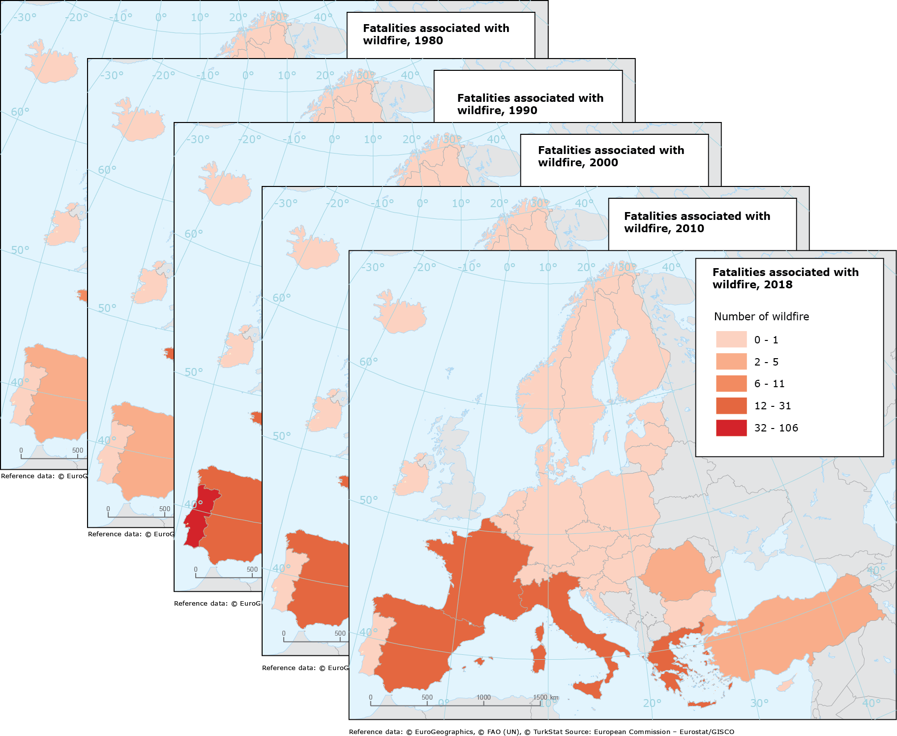
Fatalities associated with wildfires 1980-2022, Oct. 2023
This metadata refers to a vector dataset that shows the number of fatalities caused by wildfires. The dataset covers the EEA-38 member countries over the period 1980-2022.
The dataset is part of the European Climate Adaptation Platform (Climate-ADAPT) accessible here: https://climate-adapt.eea.europa.eu/observatory/evidence/health-effects/wildfires
The data is based on the damage records from CATDAT of RiskLayer under a contract and with 'non disclosure' provisions.
Sources: Based on the damage records from CATDAT of RiskLayer
Simple
Identification info
- Date (Creation)
- 2023-10-01
- Date (Publication)
- 2023-10-13
- Edition
-
01.00
- Citation identifier
- eea_v_3035_100_k_wildfire-fatalities_i_1980-2022_v01_r00
- Point of contact
-
Organisation Individual Electronic mail address Website Role European Environment Agency
Point of contact European Environment Agency
Custodian
- Spatial representation type
- Vector
Spatial resolution
Equivalent scale
- Denominator
- 100000
- Topic category
-
- Environment
Extent
))
Temporal extent
- Time period
- 1980-01-01 2022-12-31
Extent
Extent
- Description
-
EEA38 (from 2020)
))
- Maintenance and update frequency
- Not planned
- GEMET
-
-
natural risk
-
- Continents, countries, sea regions of the world.
-
-
EEA38 (from 2020)
-
- Spatial scope
-
-
European
-
- EEA topics
-
-
Extreme weather
-
Resource constraints
- Access constraints
- Other restrictions
Resource constraints
- Use constraints
- Other restrictions
- Other constraints
-
The dataset has been provided to EEA by RiskLayer under a contract and with 'non disclore' provisions. Therefore, the dataset is protected by copyright and cannot be made public accessible.
- Language
- English
Distribution Information
- Distribution format
-
-
Geopackage
-
GDB
-
- OnLine resource
-
Direct download (Eionet authentication)
- OnLine resource
-
Fatalities associated with wildfires (1980-2022)
Data quality info
- Hierarchy level
- Dataset
Report
Result
- Title
- Commission Regulation (EU) No 1089/2010 of 23 November 2010 implementing Directive 2007/2/EC of the European Parliament and of the Council as regards interoperability of spatial data sets and services
- Date (Publication)
- 2010-12-08
- Explanation
-
See the referenced specification
Resource lineage
- Statement
-
The number of fatalities from individual wildfire events (recording all events that mentioned wildfires) were aggregated for calendar years for the EEA38 member countries.
The data is based on the damage records from CATDAT of RiskLayer GmBH ( https://www.risklayer.com/data.html)
- Hierarchy level
- Dataset
Reference System Information
Reference System Information
- Code
- EPSG:3035
Metadata
- Metadata identifier
- 5a53c027-1c63-4fa7-81c6-3e1b2b259318
- Language
- English
- Character encoding
- UTF8
- Contact
-
Organisation Individual Electronic mail address Website Role European Environment Agency
Point of contact
Type of resource
- Resource type
- Dataset
- Metadata linkage
-
https://sdi.eea.europa.eu/catalogue/srv/api/records/5a53c027-1c63-4fa7-81c6-3e1b2b259318
- Date info (Creation)
- 2023-10-11T11:25:16.002Z
- Date info (Revision)
- 2025-10-09T10:52:08.658028Z
Metadata standard
- Title
-
ISO 19115/19139
- Edition
-
1.0
),POLYGON((44.807%2027.642,44.807%2071.165,-31.285%2071.165,-31.285%2027.642,44.807%2027.642))))