 EEA geospatial data catalogue
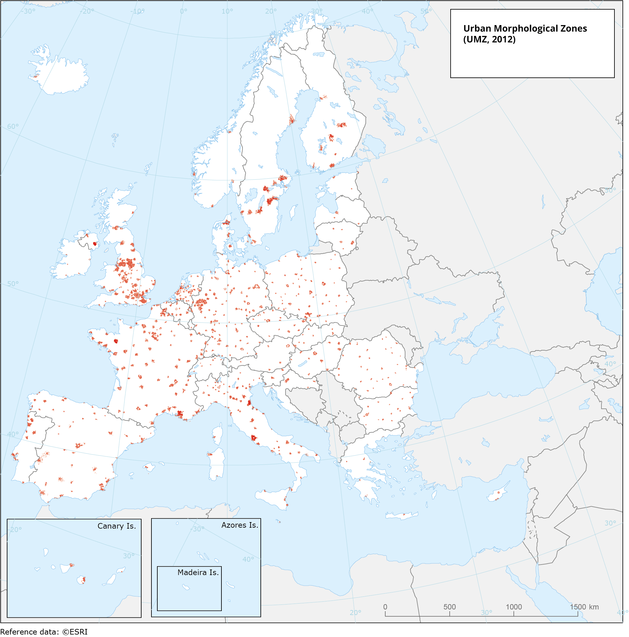
Urban Morphological Zone (2012) within cities included in Urban Audit 2011-2014, Jan. 2019
This vector dataset presents the Urban Morphological Zones (UMZ) for reference year 2012 clipped by the city administrative boundaries from Urban Audit 2011-2014 from Eurostat.
A UMZ is defined as ‘a set of urban areas laying less than 200 m apart’. Those urban areas are defined with land cover classes contributing to the urban tissue and function. The UMZ 2012 dataset has been derived from the Copernicus Urban Atlas 2012 by using urban core classes (residential, industrial and commercial, green urban areas) and adding enlarged core classes if they fulfil certain neighbourhood conditions of the core classes. The UMZ is a reference unit for city morphology as the best approximation of the ‘real’ city form, which often does not correspond to the administrative delineation. The UMZ more accurately reflects the physical shape of cities compared to the administrative boundaries.
Simple
Identification info
- Date (Creation)
- 2018-12-19T00:00:00
- Date (Publication)
- 2019-01-07T00:00:00
- Edition
-
01.00
- Citation identifier
- eea_v_4258_100_k_umz-2012-urbanaudit_p_2012_v01_r00
- Spatial representation type
- Vector
Spatial resolution
Equivalent scale
- Denominator
- 100000
- Topic category
-
- Environment
- Climatology, meteorology, atmosphere
Extent
Temporal extent
- Time period
- 2012-01-01 2012-12-31
Extent
Extent
))
- Maintenance and update frequency
- Not planned
- GEMET
-
-
climate change adaptation
-
climate
-
built-up area
-
urban area
-
city
-
climate change impact
-
- Continents, countries, sea regions of the world.
-
-
EU27 (from 2020)
-
Iceland
-
Norway
-
Switzerland
-
United Kingdom
-
- EEA topics
-
-
Land use
-
Sustainability solutions
-
Resource constraints
- Access constraints
- Other restrictions
- Other constraints
- no limitations to public access
Resource constraints
- Use constraints
- Other restrictions
- Other constraints
-
License CC-BY 4.0 ( https://creativecommons.org/licenses/by/4.0/). Copyright holder: European Environment Agency (EEA),
The geometry of the dataset is derived from the Urban Audit Cities 2011-2014 dataset is publicly available and can be used for non commercial purposes. The source and intellectual property have always to be acknowledged for the original data and for derived data. Copyright holder: © EuroGeographics © FAO (UN) © TurkStat.
- Language
- English
Distribution Information
Data quality info
- Hierarchy level
- Dataset
Report
Result
- Title
-
Commission Regulation (EU) No 1089/2010 of 23 November 2010 implementing Directive 2007/2/EC of the European Parliament and of the Council as regards interoperability of spatial data sets and services
- Date (Publication)
- 2010-12-08
- Explanation
-
See the referenced specification
Resource lineage
- Statement
-
The Urban Morphological Zone (UMZ) is a reference unit for city morphology (as the best approximation of the ‘real’ city form, which often does not correspond to the administrative delineation). UMZ more accurately reflects the physical shape of cities compared to the administrative boundaries.
The UMZ have been derived from the Copernicus Urban Atlas 2012 by using urban core classes (residential, industrial and commercial, green urban areas) and adding enlarged core classes if they fulfil certain neighbourhood conditions of the core classes. The UMZs have been clipped by the city administrative boundaries, from the Urban Audit 2011-2014 polygons ( https://ec.europa.eu/eurostat/web/gisco/geodata/statistical-units/urban-audit#ua11-14) to include only the areas within the city administrative area.
- Hierarchy level
- Dataset
Reference System Information
Reference System Information
- Code
- EPSG:4258
Metadata
- Metadata identifier
- 747aeb4e-3baa-4628-883a-3585a1cc2f35
- Language
- English
- Character encoding
- UTF8
- Contact
-
Organisation Individual Electronic mail address Website Role European Environment Agency
Point of contact
Type of resource
- Resource type
- Dataset
- Metadata linkage
-
https://sdi.eea.europa.eu/catalogue/srv/api/records/747aeb4e-3baa-4628-883a-3585a1cc2f35
- Date info (Creation)
- 2020-09-15T10:08:47Z
- Date info (Revision)
- 2025-10-09T10:57:49.822432Z
Metadata standard
- Title
-
ISO 19115/19139
- Edition
-
1.0
)))