 EEA geospatial data catalogue
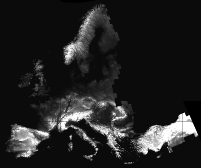
Preliminary version of a DEM over Europe from the GSGRDA project (EU-DEM-PRE, resolution 25 m)
The EU-DEM is a Digital Surface Model (DSM) representing the first surface as illuminated by the sensors. EU-DEM covers the EEA39 countries and it has been produced by a consortium led by Indra, Intermap edited the EUDEM and AGI provided the water mask. The EU-DEM is a 3D raster dataset with elevations captured at 1 arc second postings (2.78E-4 degrees) or about every 30 meter. It is a hybrid product based on SRTM and ASTER GDEM data fused by a weighted averaging approach. Ownership of EU-DEM belongs to European Commision, DG Enterprise and Industry.
The projection onto an Inspire compliant grid of 25m resolution has been performed by the Joint Research Centre of the European Commission.
Simple
Identification info
- Date (Creation)
- 2012-05-01
- Citation identifier
- entr_r_3035_25_m_gsgrda-eudem_i_2012_v00_r00
- Status
- Obsolete
- Spatial representation type
- Grid
Spatial resolution
- Spatial resolution
- 25 m
- Topic category
-
- Elevation
Extent
))
Extent
Temporal extent
- Time period
- 2000-01-01 2010-12-31
- GEMET - INSPIRE themes, version 1.0
-
-
Elevation
-
Hydrography
-
- GEMET
-
-
hydrography
-
mapping
-
cartography
-
geography
-
geodesy
-
photogrammetry
-
radar
-
remote sensing
-
Resource constraints
- Use limitation
-
Premilinary data delivered in the course of the GSGRDA* contract of DG ENTR.
All data and descriptions herein are COMPANY CONFIDENTIAL and for EVALUATION purposes ONLY.
They must stay strictly INTERNAL (i.e. within EU Institutions).
Only after acceptance of the product by DG ENTR these data may be disclosed.
Resource constraints
- Access constraints
- restricted
- Use constraints
- restricted
- Language
- English
- Character encoding
- UTF8
Distribution Information
- Distribution format
-
-
GeoTIFF
-
- OnLine resource
-
Direct download (Eionet authentication)
Data quality info
- Hierarchy level
- Dataset
Report
Result
- Title
-
Commission Regulation (EU) No 1089/2010 of 23 November 2010 implementing Directive 2007/2/EC of the European Parliament and of the Council as regards interoperability of spatial data sets and services
- Date (Publication)
- 2010-12-08
- Explanation
-
See the referenced specification
Resource lineage
- Statement
-
The EU-DEM data product is derived from an automated data fusion process using SRTM and ASTER GDEM digital surface model (DSM) data. Intermap's NEXTMap Europe dataset is utilized to remove any consistent horizontal bias in the GDEM data. The EU-DEM product is edited to ensure that water features are adequately represented and consistent with the hydrography layer provided by Aerogeodezijos Institutas (AGI) in Kaunas, Lithuania. Residual clouds within the GDEM data are identified and removed same as suspect data extremely differing from the SRTM data. All EU-DEM tiles are edited interactively in a 3D stereo environment. The editing is restricted to the hydrographic features and pits and bumps. In areas above 60 degress North, the EU-DEM generation process is supported by other DEM data sources provided by JRC. Water features are flattened (oceans, lakes) and stepped (rivers) based on the hydrography data produced by AGI. The spatial reference system of the original EU-DEM is geographic, lat/lon with horizontal datum ETRS89, ellipsoid GRS80 and vertical datum EVRS2000 with geoid EGG08.
This dataset has been projected to ETRS89/ETRS-LAEA (EPSG code 3035).
- Hierarchy level
- Dataset
Reference System Information
Reference System Information
- Code
- EPSG:3035
Metadata
- Metadata identifier
- 7b0b89e3-055e-4d74-a98b-02a788b3a481
- Language
- English
- Character encoding
- UTF8
- Contact
-
Organisation Individual Electronic mail address Website Role European Environment Agency
Point of contact
Type of resource
- Resource type
- Dataset
- Metadata linkage
-
https://sdi.eea.europa.eu/catalogue/srv/api/records/7b0b89e3-055e-4d74-a98b-02a788b3a481
- Date info (Creation)
- 2012-05-16T07:53:56Z
- Date info (Revision)
- 2025-10-09T10:59:07.013283Z
Metadata standard
- Title
-
ISO 19115/19139
- Edition
-
1.0
)))