 EEA geospatial data catalogue
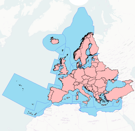
EuroRegionalMap (full European coverage) - version 9.0, Jan. 2016
EuroRegionalMap v9.0 is a pan-European dataset containing topographic information at the scale 1:250 000 covering: 27 EU member states (excluding Croatia), 4 EFTA states (Liechtenstein, Norway, Iceland, Switzerland), Republic of Moldova, Serbia, Kosovo and Georgia. It is a seamless and harmonised data and is produced in cooperation by the National Mapping and Cadastral Agencies of Europe, using official national databases.
Thematic layers:
Administrative Boundaries,
Hydrography,
Settlements,
Transport,
Points of Interests,
Named Location,
Miscellaneous,
Vegetation and
Soil.
Simple
Identification info
- Date (Creation)
- 2006-12-31
- Date (Revision)
- 2015-12-31
- Edition
-
90
- Citation identifier
- eurogeographics_v_4258_250_k_erm-europe_i_2015_v09_r00
- Status
- Superseded
- Spatial representation type
- Vector
Spatial resolution
Equivalent scale
- Denominator
- 250000
- Topic category
-
- Utilities communication
- Boundaries
- Location
- Inland waters
- Transportation
Extent
))
Extent
Temporal extent
- Time period
- 2015-05-01 2015-12-31
- Maintenance and update frequency
- As needed
- GEMET - INSPIRE themes, version 1.0
-
-
Soil
-
Sea regions
-
Hydrography
-
Transport networks
-
Population distribution — demography
-
Administrative units
-
- GEMET
-
-
water body
-
drainage
-
harbour
-
estuary
-
in situ
-
administrative boundary
-
transportation
-
railway network
-
waterfall
-
route planning
-
maritime transport
-
railway
-
dam
-
car park
-
lake
-
glacier
-
human settlement
-
road
-
airport
-
highway
-
geo-referenced data
-
national boundary
-
railway station
-
water (geographic)
-
river
-
built-up area
-
built environment
-
inland water
-
international watercourse
-
artificial lake
-
vegetation
-
coast
-
high-speed railway
-
geography
-
tidal water
-
waterway
-
surface water
-
- Continents, countries, sea regions of the world.
-
-
Montenegro
-
Monaco
-
Bosnia and Herzegovina
-
North Macedonia
-
Andorra
-
Serbia
-
Kosovo (UNSCR 1244/99)
-
Georgia
-
Moldova
-
EU27 (2007-2013)
-
EFTA4
-
Resource constraints
- Use limitation
-
Please refer to the documents GISCO-LicenseconditionsforEuroGeographicsAdministrativeandTopographicspatialdatasets-080716-1335-618.pdf and Data_Request_Form_EuroGeographics.doc under ERM9/Licence.
Resource constraints
- Access constraints
- intellectualPropertyRights
- Access constraints
- Other restrictions
- Other constraints
-
License
- Language
- English
- Character encoding
- UTF8
Distribution Information
- Distribution format
-
-
GDB
-
- OnLine resource
-
Direct download (Eionet authentication)
Data quality info
- Hierarchy level
- Dataset
Report
Result
- Title
-
Commission Regulation (EU) No 1089/2010 of 23 November 2010 implementing Directive 2007/2/EC of the European Parliament and of the Council as regards interoperability of spatial data sets and services
- Date (Publication)
- 2010-12-08
- Explanation
-
See the referenced specification
Resource lineage
- Statement
-
See ERM(EC)_v90_Lineage.doc
- Hierarchy level
- Dataset
Reference System Information
- Reference system identifier
- OGP Surveying & Positioning Committee/urn:ogc:def:crs:EPSG:7.1:4258
Metadata
- Metadata identifier
- 85a5772c-d86c-4d39-bb0a-6140a8486a1b
- Language
- English
- Character encoding
- UTF8
- Contact
-
Organisation Individual Electronic mail address Website Role European Environment Agency
Point of contact
Type of resource
- Resource type
- Dataset
- Metadata linkage
-
https://sdi.eea.europa.eu/catalogue/srv/api/records/85a5772c-d86c-4d39-bb0a-6140a8486a1b
- Date info (Creation)
- 2016-08-16T09:24:03Z
- Date info (Revision)
- 2025-10-09T11:01:19.209002Z
Metadata standard
- Title
-
ISO 19115/19139
- Edition
-
1.0
)))