 EEA geospatial data catalogue
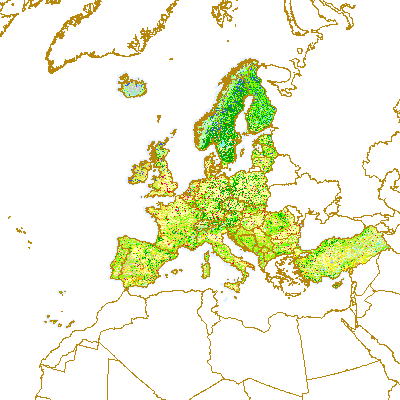
Corine Land Cover 2006 (raster 100m) - version 15, Aug. 2011
With the help of CLC data it is possible to provide support for protecting ecosystems, halting the loss of biological diversity, tracking the impacts of climate change, assessing developments in agriculture and implementing the EU Water Framework Directive. CLC data is an important data set for the implementation of key priority areas of the Sixth Environment Action Programme of the European Community. CLC data can show, for instance, where fragmentation of the landscape by roads and other infrastructure is worsening and thus increasing the risk that ecosystems can no longer connect with each other, putting the survival of their flora and fauna in danger. In the agricultural field CLC data can highlight where major structural changes are continuing or intensifying, such as the conversion of pasture to arable land, expansion or reduction in the area of fallow land and land taken out of production ('set aside'), or the abandonment of farming altogether. CLC serve as input to the EC 'Inspire' (INfrastructure for SPatial InfoRmation in Europe - http://inspire.jrc.it) initiative. This initiative intends to trigger the creation of a European spatial information infrastructure that delivers to the users integrated spatial information services. CLC programme is also a contribution to the Global Monitoring for Environment and Security (GMES http://gmes.info) initiative, run by the European Commission and the European Space Agency, to provide environmental information from a combination of air- and space-based observation systems and in-situ monitoring.
Simple
Identification info
- Date (Publication)
- 2011-08-24
- Date (Publication)
- 2011-08-24
- Date (Creation)
- 2011-08-12
- Edition
-
15
- Citation identifier
- eea_r_3035_100_m_clc-2006_p_2006_v15_r00
- Status
- Obsolete
- Point of contact
-
Organisation Individual Electronic mail address Website Role European Environment Agency
Point of contact European Environment Agency
Custodian
- Spatial representation type
- Grid
Spatial resolution
- Spatial resolution
- 100 m
- Topic category
-
- Environment
- Geoscientific information
Extent
))
Extent
Temporal extent
- Time period
- 2006-01-01 2006-12-31
- Maintenance and update frequency
- Biannually
- GEMET - INSPIRE themes, version 1.0
-
-
Land cover
-
- EEA topics
-
-
Land use
-
Resource constraints
- Use constraints
- Other restrictions
- Other constraints
-
License CC-BY 4.0 ( https://creativecommons.org/licenses/by/4.0/). Copyright holder: European Environment Agency (EEA).
Resource constraints
- Access constraints
- Other restrictions
- Other constraints
- no limitations to public access
- Language
- English
- Character encoding
- UTF8
Data quality info
- Hierarchy level
- Dataset
Report
Result
- Title
-
Commission Regulation (EU) No 1089/2010 of 23 November 2010 implementing Directive 2007/2/EC of the European Parliament and of the Council as regards interoperability of spatial data sets and services
- Date (Publication)
- 2010-12-08
- Explanation
-
See the referenced specification
Resource lineage
- Statement
-
Product is based on CLC databases provided by National Teams within CLC mapping related projects (I&CLC2000, CARDS, FTSP/CLC2006 update etc.. All features in original vector database were classified and digitised based on satellite images with 100 m positional accuracy (according to CLC specifications) and 25 ha minimum mapping unit (5ha MMU for changes) into the standardized CLC nomenclature (44 CLC classes). LCEUGRIDS represent the final product of European CLC data integration. The process of data integration started when national CLC deliveries have been accepted. Delivered national data were produced in local national systems of all participating countries. Each national Coordinate Reference System (CRS) definition had to be known precisely together with its geometric relationship to a standard system in order to accurately transfer all national data into a standard coordinate reference (LAEA5210/ETRS89) for European wide geographic data. Mostly, the process itself was carried out by global equation-based transformation to ETRS89 (e.g. seven-parameters Bursa-Wolf methods). The accuracy of a particular transformation ranges from centimetres to meters depending on the method and the quality and number of control points available to define the transformation parameters, but, in any case, the accuracy is far above the actual CLC2000 data resolution (for more details see DBTA reports for particular country). Due to large data volume, national data, when transformed into the common European reference, are rasterized. The resolution of the data is 100 x 100 and 250 x 250 metres (change grids 100 x 100 metres).
Changes:
Version 13 (02/2010) Production date: February 16th, 2010 This is the 13th CLC grid update and 5nd version containing also data from CLC2006 update (36 countries - only UK, CH and GR data still missing from complete CLC2006 coverage). Changes from previous releases: version 13 (02/2010) - 7 new countries added to CLC2006 layers (DE, ES, FI, IT, NO, SE, TR), reflected in particular in lceugr100_06 directory: lceugr100_06.tif - CLC2006 status data in 100m grid resolution lceugr250_06 directory: lceugr250_06.tif - CLC2006 status data in 250m grid resolution lceugr100_cha06 directory: lceugr100_cha06_00.tif - consumption CLC2000 code in changed areas (change 2000-2006) in 100m grid resolution lceugr100_cha06_06.tif - formation CLC2006 code in changed areas (change 2000-2006) in 100m grid resolution - 1 new countries added to CLC2000 layers (TR) reflected in particular in lceugr100_00 directory: lceugr100_00.tif - CLC2000 status data in 100m grid resolution lceugr250_00 directory: lceugr250_00.tif - CLC2000 status data in 250m grid resolution - 1 country updated in CLC2000 (NO - update of previous version from national team) reflected in particular in lceugr100_00 directory: lceugr100_00.tif - CLC2000 status data in 100m grid resolution lceugr250_00 directory: lceugr250_00.tif - CLC2000 status data in 250m grid resolution - sea/ocean (gridcode 44) and unclassified land (gridcode 49) added to all status layers in order to have consistent sea/ocean coverage over all datasets reflected in particular in lceugr100_06 directory: lceugr100_06.tif - CLC2006 status data in 100m grid resolution lceugr250_06 directory: lceugr250_06.tif - CLC2006 status data in 250m grid resolution lceugr100_00 directory: lceugr100_00.tif - CLC2000 status data in 100m grid resolution lceugr250_00 directory: lceugr250_00.tif - CLC2000 status data in 250m grid resolution lceugr100_90 directory: lceugr100_90.tif - CLC1990 status data in 100m grid resolution lceugr250_90 directory: lceugr250_90.tif - CLC1990 status data in 250m grid resolution version 12 (09/2009) - 9 new countries added to CLC2006 layers (AT, BE, DK, HU, IS, LI, MK, MT, PT), in particular to lceugr100_06 directory: lceugr100_06_pct.tif - CLC2006 status data in 100m grid resolution lceugr250_06 directory: lceugr250_06_pct.tif - CLC2006 status data in 250m grid resolution lceugr100_cha06 directory: lceugr100_cha06_06_pct.tif - CLC2006 status of changed areas (change 2000-2006) in 100m grid resolution lceugr100_cha06_00_pct.tif - CLC2000 status of changed areas (change 2000-2006) in 100m grid resolution - 2 new countries added to CLC2000 layers (IS,NO) 1 country updated in CLC2000 (MT) due to changed geometry in CLC2006 delivery reflected in particular in lceugr100_00 directory: lceugr100_00_pct.tif - CLC2000 status data in 100m grid resolution lceugr250_00 directory: lceugr250_00_pct.tif - CLC2000 status data in 250m grid resolution - 1 country updated in CLC1990 (MT) due to changed geometry in CLC2006 delivery reflected in particular in lceugr100_00 directory: lceugr100_00_pct.tif - CLC2000 status data in 100m grid resolution lceugr250_00 directory: lceugr250_00_pct.tif - CLC2000 status data in 250m grid resolution - 1 country added in CLC1990 (MT) - delivered as part of CLC2006 delivery reflected in particular in lceugr100_90 directory: lceugr100_90_pct.tif - CLC1990 status data in 100m grid resolution lceugr250_90 directory: lceugr250_90_pct.tif - CLC1990 status data in 250m grid resolution - 1 country added in CHANGE9000 (MT) - delivered as part of CLC2006 delivery reflected in particular in lceugr100_cha00 directory: lceugr100_cha00_00_pct.tif - CLC2000 status of changed areas (change 1990-2000) in 100m grid resolution lceugr100_cha00_90_pct.tif - CLC1990 status of changed areas (change 1990-2000) in 100m grid resolution version 11 (03/2009) - 11 new countries added to CLC2006 layers (AL, BA, CZ, FR, HR, IE, KV, ME, MK, PL, RS, SK), in particular to lceugr100_06 directory: lceugr100_06_pct.tif - CLC2006 status data in 100m grid resolution lceugr250_06 directory: lceugr250_06_pct.tif - CLC2006 status data in 250m grid resolution lceugr100_cha06 directory: lceugr100_cha06_06_pct.tif - CLC2006 status of changed areas (change 2000-2006) in 100m grid resolution lceugr100_cha06_00_pct.tif - CLC2000 status of changed areas (change 2000-2006) in 100m grid resolution - 1 new country added to CLC2000 layers (KV), in particular to lceugr100_00 directory: lceugr100_00_pct.tif - CLC2000 status data in 100m grid resolution lceugr250_00 directory: lceugr250_00_pct.tif - CLC2000 status data in 250m grid resolution - 16 tecnical change polygons corrected (technical no-change polygons deleted) for 2000-2006 change layers, in particular for LT, LU, LV, SI fixed in lceugr100_cha06 directory: lceugr100_cha06_06_pct.tif - CLC2006 status of changed areas (change 2000-2006) in 100m grid resolution lceugr100_cha06_00_pct.tif - CLC2000 status of changed areas (change 2000-2006) in 100m grid resolution version 10 - new clc grids has been added for first available CLC2006 countries (BG, EE, LV, LT, LU, NL, RO, SI) lceugr100_06 directory contains: lceugr100_06_pct.tif - CLC2006 status data in 100m grid resolution lceugr250_06 directory contains: lceugr250_06_pct.tif - CLC2006 status data in 250m grid resolution lceugr100_cha06 directory contains: lceugr100_cha06_06_pct.tif - CLC2006 status of changed areas (change 2000-2006) in 100m grid resolution lceugr100_cha06_00_pct.tif - CLC2000 status of changed areas (change 2000-2006) in 100m grid resolution - 1990-2000 change data (both directory and files) has been renamed to distinguish CLC2000 and CLC2006 change datasets. lceugr100_cha00 directory contains: lceugr100_cha00_00_pct.tif - CLC2000 status of changed areas (change 1990-2000) in 100m grid resolution lceugr100_cha00_90_pct.tif - CLC1990 status of changed areas (change 1990-2000) in 100m grid resolution - LCF grid removed from delivery version 09.1 - new clc grids has been added (lceugr100_change directory) in addition to LCF grid lceugr100_ch00_pct.tif - CLC2000 status of changed areas in 100m grid resolution lceugr100_ch90_pct.tif - CLC1990 status of changed areas in 100m grid resolution version 09 - Serbia and Montenegro data added into CLC90, CLC00 and CHANG(LCF) grids (output from CARDS project) - new version of color specifications included (*.lyr files). Works properly for ArcGIS9.2+version only as any raster symbology didn't work for pre-ArGIS9.2 releases. version 08 - clc change grid included based on LCF definition - PCT table have been edited to include colors specification for relevant values only - new legend files included (*.xls) - new color specifications included (*.lyr files) version 07 - second release based on seamless CLC data including country border harmonization - also CLC90 data are border harmonized version 06 - first release based on seamless CLC data including country border harmonization - Ireland geometry have been improved (~20m shift) version 05 - new countries added Albania, data added to 100_00, 250_00 *1996, but data considered as 2000 Bosnia-Herzegovina, data added to 100_00, 250_00 *1998, but data considered as 2000 Croatia, 100_00, 100_90, 250_00, 250_90 North Macedonia, 100_00, 250_00 *1996, but data considered as 2000 United Kingdom, 100_00, 250_00 version 04 - harmonized with standard EEA reference grids (08 Apr 2005) - The former unclassified land areas (value 49) and ocean and sea (value 50) values have been assigned into NODATA values. The former version including unclassified land areas (value 49) and ocean, sea and the unclassified sea (value 50) is released separately as LCEUGRIDS_V4_WITH_BACK. This differentiation has been introduced in order to support better both analytical and presentation purposes.
- Hierarchy level
- Dataset
Reference System Information
Reference System Information
- Code
- EPSG:3035
Metadata
- Metadata identifier
- 87a1e572-e9fa-4090-803a-eb576ddff644
- Language
- English
- Character encoding
- UTF8
- Contact
-
Organisation Individual Electronic mail address Website Role European Environment Agency
Point of contact
Type of resource
- Resource type
- Dataset
- Metadata linkage
-
https://sdi.eea.europa.eu/catalogue/srv/api/records/87a1e572-e9fa-4090-803a-eb576ddff644
- Date info (Creation)
- 2011-09-13T16:30:08Z
- Date info (Revision)
- 2025-10-09T11:01:42.329808Z
Metadata standard
- Title
-
ISO 19115/19139
- Edition
-
1.0
)))