 EEA geospatial data catalogue
Soil Water Index 2007-present (raster 12.5 km), global, daily - version 3
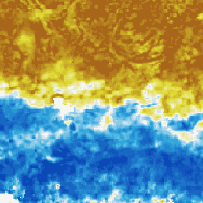
The Soil Water index (SWI) product provides global daily information about moisture conditions in different soil layers. SWI daily images are produced from EUMETSAT ASCAT-25km SSM product in orbit format and include a quality flag indicating the availability of SSM measurements for SWI calculations. Soil moisture is a key parameter in numerous environmental studies including hydrology, meteorology and agriculture. In addition to Surface Soil Moisture (SSM), information on the moisture condition within the underlying soil profile is of interest for different applications. Soil moisture in plant root zone can be estimated by an infiltration model using information on surface soil moisture and soil characteristics.
The data are available over the globe at the spatial resolution of 0.1° and with the temporal extent from January 2007 to present.
Simple
Identification info
- Date (Creation)
- 2017-01-01
- Date (Publication)
- 2017-12-01
- Edition
-
3
- Edition date
- 2017-01-01T00:00:00
- Citation identifier
- clms_r_4326_12.5_km_swi-daily-global_p_2007-now_v3_r00
- Citation identifier
- clms_global_swi_12.5km_v3_daily
- Title
-
ZAMG
- Date (Publication)
- 2017-01-10
Identifier
- Other citation details
-
https://land.copernicus.eu/en/products/soil-moisture/daily-soil-water-index-global-v3-0-12-5km
- Purpose
-
This product is first designed to fit the requirements of the Global component of the Copernicus Land service. It can be also useful for all applications related to environment monitoring.
- Credit
-
The research leading to these results has received funding from the European Community's Seventh Framework Program (FP7/2007-2013) and is maintained through the Copernicus European Earth monitoring program, more particularly through the Global component of the Copernicus Land service. This product is the joint property of the Technical University of Wien and ZAMG under copyright Copernicus. It has been generated from Metop/ASCAT surface soil moisture data distributed by Eumetsat.
- Point of contact
-
Organisation Individual Electronic mail address Website Role European Commission
Owner Copernicus Land Monitoring Service
Custodian European Commission's Joint Research Centre
Publisher Copernicus Land Monitoring Service helpdesk
Point of contact
- Spatial representation type
- Grid
Spatial resolution
- Spatial resolution
- 0.1 deg
- Topic category
-
- Imagery base maps earth cover
- Biota
- Farming
- Environment
Extent
))
Extent
Temporal extent
- Time period
- 1-day composite daily 2007-01-01T00:00:00Z
- Maintenance and update frequency
- As needed
- mmi:updateScope
- Series
Resource format
- Title
-
HDF
- Alternate title
-
Hierarchical Data Format
- Date
- Edition
-
5
- Continents, countries, sea regions of the world.
-
-
World
-
- Theme
-
-
biogeophysical
-
soil water index
-
soil moisture
-
- Place
-
-
global
-
- Temporal
-
-
Daily
-
daily composite
-
Resource constraints
- Access constraints
- Other restrictions
- Other constraints
- no limitations to public access
Resource constraints
- Use constraints
- Other restrictions
- Other constraints
-
The Copernicus component is governed by Regulation (EU) No 2021/696 of the European Parliament and of the Council of 28 April 2021 establishing the Union Space Programme and the European Union Agency for the Space Programme and repealing Regulations (EU) No 912/2010, (EU) No 1285/2013 and (EU) No 377/2014 and Decision No 541/2014/EU. Within the Copernicus component, a portfolio of land monitoring activities has been delegated by the European Union to the European Environment Agency (EEA) and the DG Joint Research Centre of the European Commission.
The Copernicus land monitoring products and services are made available on a principle of full, open and free access, as established by the Commission Delegated Regulation (EU) No 1159/2013 of 12 July 2013.
Free, full and open access to the products and services of the Copernicus Land Monitoring Service is made on the conditions that:
1. When distributing or communicating Copernicus Land Monitoring Service products and services (data, software scripts, web services, user and methodological documentation and similar) to the public, users shall inform the public of the source of these products and services.
2. Where the Copernicus Land Monitoring Service products and services have been adapted or modified by the user, the user shall clearly state this.
3. Users shall make sure not to convey the impression to the public that the user's activities are officially endorsed by the European Union.
- Language
- English
- Character encoding
- UTF8
Distribution Information
- Distribution format
-
-
ZIP archive
- File decompression technique
-
unzip or pkunzip
-
- Fees
-
Free
- Ordering instructions
-
Products can be downloaded on-line via HTTP. They are also available through EUMETCAST. Bulk downloads and near-real time dissemination can be requested at our helpdesk.
- Units of distribution
-
Per product
- OnLine resource
-
OGC WMTS
- OnLine resource
-
Copernicus Data Space Ecosystem download services
- Units of distribution
-
Per product
- OnLine resource
-
Copernicus Browser
Data quality info
- Hierarchy level
- Dataset
Report
Result
- Title
-
Validation results conform CEOS LPV guidelines
- Date (Publication)
- 2010-12-01
- Explanation
-
https://land.copernicus.eu/en/products/soil-moisture/daily-soil-water-index-global-v3-0-12-5km
- Pass
- true
Report
Result
- Date (Publication)
- 2010-12-08
- Explanation
-
This data set is conformant with the INSPIRE Implementing Rules for the interoperability of spatial data sets and services
- Pass
- true
Report
Result
- Title
- INSPIRE Data Specification on orthoimagery - Guidelines
- Date (Publication)
- 2010-04-26
- Explanation
-
See the referenced specification
- Pass
- true
Resource lineage
- Statement
-
The SWI algorithm, originally developed at Vienna University of Technology (TU Wien) and later improved by other research groups, uses an infiltration model describing the relation between surface soil moisture and profile soil moisture as a function of time. The algorithm is based on a two-layer water balance model to estimate profile soil moisture from SSM retrieved from scatterometer data. The remotely sensed topsoil represents the first layerand the second layer extends downwards from the bottom of the surface layer. In this model, the water content of the reservoir layer is described in terms of an Index, which is controlled only by the past soil moisture conditions in the surface layer in a way that the influence of measurements decreases by increasing the time. The SWI processing algorithm uses near-real-time ASCAT-25km SSM product as input to generate daily global SWI images. Therefore a computational adaption of SWI algorithm has been made based on a recursive formulation. In this method, a gain factor is introduced that relates the past SWI measurements to the current measurements. SWI images are calculated for eight different T values (1, 5, 10, 15, 20, 40, 60, 100) together with the respective quality flags. The SWI quality flag is a parameter related to the number of available SSM measurements used for calculation of SWIT at time t. It is calculated also by using a recursive formulation and expressed in percentage after normalization.
- Hierarchy level
- Dataset
Spatial representation info
- Number of dimensions
- 2
- Dimension name
- Row
- Dimension size
- 1800
- Resolution
- 0.1
- Dimension name
- Column
- Dimension size
- 3600
- Resolution
- 0.1
- Cell geometry
- Area
- Transformation parameter availability
- false
- Check point availability
- true
- Check point description
-
Upperleft corner tiepoint
- Description
- Upperleft corner tiepoint
- Identifier
- upperLeftTiePoint
- Name
- Tie Point in upper left corner
- Pixel orientation code
-
Reference System Information
Reference System Information
- Code
- EPSG:4326
- Maintenance and update frequency
- As needed
Metadata
- Metadata identifier
- 98c5e00e-3580-4bb3-9509-50a572b1e935
- Language
- English
- Character encoding
- UTF8
- Contact
-
Organisation Individual Electronic mail address Website Role Copernicus Land Monitoring Service
Point of contact
Type of resource
- Resource type
- Dataset
- Metadata linkage
-
https://sdi.eea.europa.eu/catalogue/srv/api/records/98c5e00e-3580-4bb3-9509-50a572b1e935
- Date info (Creation)
- 2024-12-17T06:50:28.337087Z
- Date info (Revision)
- 2025-10-09T11:05:11.489813Z
Metadata standard
- Title
-
ISO 19115/19139
- Edition
-
1.0
)))