 EEA geospatial data catalogue
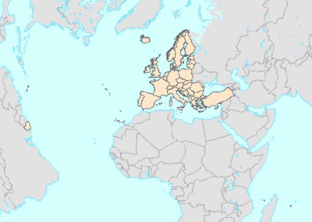
Copernicus EEA39 Border Expert product (vector), version 3, Jan. 2019
For the provision of land monitoring services within the Copernicus programme, a consistent, stable, sufficiently detailed boundary layer is required at EEA, which provides a “land mask” for the area that needs to be monitored.
This metadata refers to the Border Expert product covering EEA38 and the United Kingdom (former EEA39) in vector format (GDB, SHP), including the French DOM (Saint-Barthelemy BL, Saint Martin MF, French Guiana GF, Guadeloupe GP, Martinique MQ, Mayotte YT and Reunion RE) as well as the Falkland Islands (FK).
This is an intermediate product which is further derived from the EU-Hydro Coastline Version 3 from EEA, the EEA coastline for analysis Version 2, the EBM GISCO Hybrid Layer from EEA, the “Water and Wetness High Resolution Layer 2015” from EEA and the JRC-Global Surface Water Occurrence layer.
The production of this Border Expert Product was coordinated by the European Environment Agency in the frame of the EU Copernicus programme.
IMPORTANT NOTE: This dataset is only available for internal use within EEA in the context of the EU Copernicus programme. Copyright restrictions apply, as in this product ungeneralised data from EuroGeographics EuroBoundary Map Version 12 is included. Use of this dataset has therefore to be agreed with EEA and ultimately with EuroGeographics.
Simple
Identification info
- Date (Creation)
- 2019-01-15
- Edition
-
03.00
- Citation identifier
- eea_v_3035_100_k_copernicus-border-expert_i_2012-2018_v03_r00
- Point of contact
-
Organisation Individual Electronic mail address Website Role European Environment Agency
Point of contact European Environment Agency
Custodian
- Spatial representation type
- Vector
Spatial resolution
Equivalent scale
- Denominator
- 100000
- Topic category
-
- Boundaries
Extent
))
Temporal extent
- Time period
- 2012-01-01 2018-01-20
Extent
Extent
))
Extent
))
Extent
))
Extent
))
Extent
))
Extent
))
Extent
))
Extent
))
- Maintenance and update frequency
- As needed
- GEMET
-
-
administrative boundary
-
coast
-
national boundary
-
- Continents, countries, sea regions of the world.
-
-
EEA38 (from 2020)
-
United Kingdom
-
- Spatial scope
-
-
European
-
- EEA topics
-
-
Land use
-
Resource constraints
- Access constraints
- Other restrictions
Resource constraints
- Use constraints
- Other restrictions
- Other constraints
-
INTELLECTUAL PROPERTY RIGHTS: The Commission (and EEA) is authorized to distribute derived geographic data and other derived products based on EuroGeographics Administrative and Topographic spatial datasets, if (1) The original geometry is generalised to the equivalent of a scale of 1:3000000 or smaller, applying the same quality principles in terms of resolution and accuracy as for the original geographic data or if the content of information in terms of number of features is less or equal to 20% of the number of features in the original geographic data (for the data extent relevant to the data to be distributed), (2) The data is not used for commercial purpose and, (3) The source is acknowledged. More information about the acknowledgement of the source or metadata is given in the document "LicenseConditions.pdf" provided with the dataset.
- Language
- English
Distribution Information
- Distribution format
-
-
GDB
-
SHP
-
- OnLine resource
-
Direct download (Eionet authentication)
Data quality info
- Hierarchy level
- Dataset
Report
Result
- Title
-
Commission Regulation (EU) No 1089/2010 of 23 November 2010 implementing Directive 2007/2/EC of the European Parliament and of the Council as regards interoperability of spatial data sets and services
- Date (Publication)
- 2010-12-08
- Explanation
-
See the referenced specification
Resource lineage
- Statement
-
The dataset is based on EU-Hydro Coastline Version 3 from EEA, the EEA coastline for analysis Version 2, the EBM GISCO Hybrid Layer from EEA, the EuroGeographics EuroBoundary Map Version 12, the “Water and Wetness High Resolution Layer 2015” from EEA and the JRC-Global Surface Water Occurrence layer.
The production process is explained in the document provided with the dataset.
- Hierarchy level
- Dataset
Reference System Information
Reference System Information
- Code
- EPSG:3035
Reference System Information
Reference System Information
- Code
- EPSG:32740
Reference System Information
Reference System Information
- Code
- EPSG:32738
Reference System Information
Reference System Information
- Code
- EPSG:32620
Reference System Information
Reference System Information
- Code
- EPSG:32622
Reference System Information
Reference System Information
- Code
- EPSG:32721
Metadata
- Metadata identifier
- bda52886-fc81-44e0-8616-2fcdf957af80
- Language
- English
- Character encoding
- UTF8
- Contact
-
Organisation Individual Electronic mail address Website Role European Environment Agency
Point of contact
Type of resource
- Resource type
- Dataset
- Metadata linkage
-
https://sdi.eea.europa.eu/catalogue/srv/api/records/bda52886-fc81-44e0-8616-2fcdf957af80
- Date info (Creation)
- 2021-07-23T13:19:12.771Z
- Date info (Revision)
- 2025-10-09T11:12:09.656278Z
Metadata standard
- Title
-
ISO 19115/19139
- Edition
-
1.0
),POLYGON((-60.793%2014.386,-60.793%2014.88,-61.233%2014.88,-61.233%2014.386,-60.793%2014.386)),POLYGON((-60.997%2015.827,-60.997%2016.517,-61.813%2016.517,-61.813%2015.827,-60.997%2015.827)),POLYGON((45.303%20-13.076,45.303%20-12.58,44.94%20-12.58,44.94%20-13.076,45.303%20-13.076)),POLYGON((-51.617%202.109,-51.617%205.762,-54.618%205.762,-54.618%202.109,-51.617%202.109)),POLYGON((55.84%20-21.392,55.84%20-20.868,55.21%20-20.868,55.21%20-21.392,55.84%20-21.392)),POLYGON((-62.788%2017.871,-62.788%2017.961,-62.911%2017.961,-62.911%2017.871,-62.788%2017.871)),POLYGON((-57.708%20-52.936,-57.708%20-50.994,-61.642%20-50.994,-61.642%20-52.936,-57.708%20-52.936)),POLYGON((-62.97%2018.046,-62.97%2018.126,-63.154%2018.126,-63.154%2018.046,-62.97%2018.046))))