 EEA geospatial data catalogue
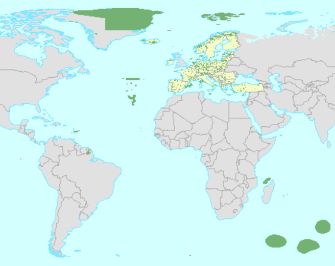
Common Database on Designated Areas (CDDA) version 19 - polygon and tabular data for internal use, Jun. 2021
The European inventory of Nationally designated areas (CDDA) holds information about designated areas and their designation types, which directly or indirectly create protected areas. The data is delivered by the Eionet partnership countries as spatial and tabular information.
The inventory began in 1995 under the CORINE programme of the European Commission. The CDDA is now an agreed annual Eionet core data flow maintained by the European Environment Agency (EEA) with support from the European Topic Centre on Biological Diversity (ETC/BD). The dataset is used by the EEA and e.g. the UNEP-WCMC for their main European and global assessments, products and services.
The CDDA is the official source of protected area information from the 38 European* countries to the World Database of Protected Areas (WDPA). Following the United Kingdom’s withdrawal from the EU on 31 January 2020, it ceased to be part of the EEA’s institutional networks and governance. The CDDA data can be queried online in the European Nature Information System (EUNIS).
This metadata refers to the internal version of the CDDA dataset version 19 (2021). EEA does not have permission to distribute some or all sites reported by Estonia, Ireland and Türkiye. The public version dataset is available with the title "Nationally designated areas (CDDA) for public access - version 19, Jun. 2020", which is derived from this dataset.
Two versions of the dataset are provided. The full dataset ("CDDA_2021_v01_internal") includes the entire geographical coverage including nationally designated areas in overseas entities. The "CDDA_2021_v01_internal_EuropeEPSG3035" version includes only continental Europe, i.e. excludes the overseas entities. Both versions are provided in GDB and GPKG formats.
The dataset is accompanied by the following tabular data: CDDA_2021_v01_internal_DesignationType.csv, which contains information about designation types and the national and international legislative instruments, which directly or indirectly create protected designated areas in Europe. The CDDA_2021_v01_public_DesignatedArea.csv, which includes information on the nationally designated sites and designated boundaries, is the same file as in the public version of this dataset, but it is also included.
* Including Kosovo (UNSCR 1244/99), which designation is without prejudice to positions on status, and is in line with UNSCR 1244 and the ICJ Opinion on the Kosovo Declaration of Independence.
Simple
Identification info
- Date (Creation)
- 2020-05-05
- Edition
-
19.00
- Citation identifier
- eea_v_3035_100_k_cdda-poly_i_2020-2021_v19_r00
- Status
- Superseded
- Point of contact
-
Organisation Individual Electronic mail address Website Role European Environment Agency
Point of contact European Environment Agency
Custodian
- Spatial representation type
- Vector
Spatial resolution
Equivalent scale
- Denominator
- 100000
- Topic category
-
- Environment
Extent
))
Extent
Temporal extent
- Time period
- 2020-01-01 2021-03-15
- Maintenance and update frequency
- Annually
- EEA topics
-
-
Biodiversity
-
Land use
-
- GEMET - INSPIRE themes, version 1.0
-
-
Protected sites
-
- Continents, countries, sea regions of the world.
-
-
EEA38 (from 2020)
-
- GEMET
-
-
natural area
-
protected area
-
natural areas protection
-
- INSPIRE priority data set
-
-
EEA Annual Work Programme
-
Nationally designated areas - CDDA
-
Resource constraints
- Access constraints
- Other restrictions
Resource constraints
- Use constraints
- Other restrictions
- Other constraints
-
The dataset contains parts which are restricted by the data providers and not to be made public. EEA does not have permission to distribute some or all sites reported by Estonia, Ireland and Türkiye.
Associated resource
- Association Type
- Revision Of
- Metadata Reference
Associated resource
- Association Type
- Cross reference
- Metadata Reference
- Language
- English
Distribution Information
- Distribution format
-
-
GDB
-
Geopackage
-
ascii (.csv, .txt, .sql)
-
- OnLine resource
-
Direct download (Eionet authentication)
Data quality info
- Hierarchy level
- Dataset
Report
Result
- Title
-
Commission Regulation (EU) No 1089/2010 of 23 November 2010 implementing Directive 2007/2/EC of the European Parliament and of the Council as regards interoperability of spatial data sets and services
- Date (Publication)
- 2010-12-08
- Explanation
-
See the referenced specification
Resource lineage
- Statement
-
The data sources for this dataset are data deliveries from the Eionet, the partnership network of the EEA and its 38 member and cooperating countries. In EU Member States the implementation of INSPIRE Directive may mean that the spatial information is provided via the national or sub-national INSPIRE data providers.
The production process will be explained in an update of the CDDA document (CDDA_v19_2021.pdf) to be provided with the dataset.
The dataset is accompanied with the file CDDA_2021_v01_internal_DesignationType.csv, which contains information about designation types and the national and international legislative instruments, which directly or indirectly create protected designated areas in Europe; the CDDA_2021_v01_public_DesignatedArea.csv, which includes information on the nationally designated sites and designated boundaries, is the same file as in the public version of this dataset, but it is also included for download together with the dataset.
- Hierarchy level
- Dataset
Reference System Information
Reference System Information
- Code
- EPSG:4326
Reference System Information
Reference System Information
- Code
- EPSG:3035
Metadata
- Metadata identifier
- c2a68bc9-543a-4cab-a168-aa20ce0d6951
- Language
- English
- Character encoding
- UTF8
- Contact
-
Organisation Individual Electronic mail address Website Role European Environment Agency
Point of contact
Type of resource
- Resource type
- Dataset
- Metadata linkage
-
https://sdi.eea.europa.eu/catalogue/srv/api/records/c2a68bc9-543a-4cab-a168-aa20ce0d6951
- Date info (Creation)
- 2021-06-16T16:11:28.519Z
- Date info (Revision)
- 2025-10-09T11:13:08.68412Z
Metadata standard
- Title
-
ISO 19115/19139
- Edition
-
1.0
)))