 EEA geospatial data catalogue
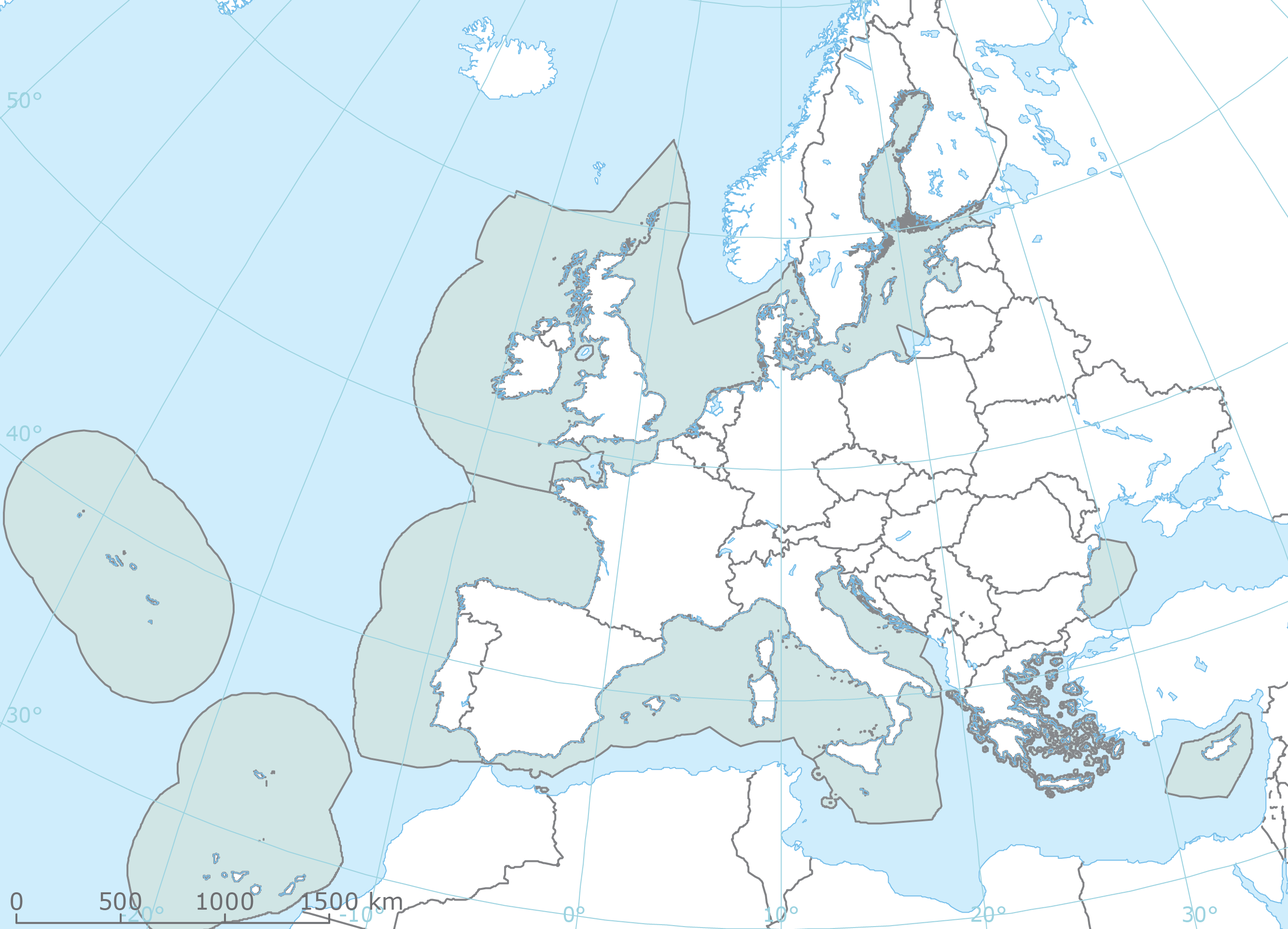
Marine Protected Areas (MPA) assessment areas - version 1, Feb. 2017
The spatial extent of the MPA assessment areas was defined as the marine waters surrounding the EU countries whose outer limit is defined by the 200 NM boundary from the coast (possibly coinciding with formally recognised EEZ boundaries) or the equidistance (in cases of opposite neighbouring EU countries), or by the presence of a boundary defined by an agreed treaty. Given no formal boundary of this map exists and since this limit coincides with the boundary of the maritime area (water column) submitted by EU Member States under MSFD, this dataset was based on a MSFD Region/Subregion boundary shapefile assembled in 2013 by ETC/ICM integrated with the Maritime Boundaries (version 7) from the Flanders Marine Institute (VLIZ).
This dataset has been used to create the map that shows the percentage marine protected area (MPA) coverage in Europe's regional seas and also the distance to the Convention on Biological Diversity Aichi target 11.
Simple
Identification info
- Date (Creation)
- 2017-02-28
- Date (Publication)
- 2017-02-28
- Edition
-
1.0
- Citation identifier
- eea_v_3035_10_mio_mpa-assessment-areas_p_2017_v01_r00
- Status
- Superseded
- Point of contact
-
Organisation Individual Electronic mail address Website Role European Environment Agency
Point of contact European Environment Agency
Custodian
- Spatial representation type
- Vector
Spatial resolution
Equivalent scale
- Denominator
- 10000000
- Topic category
-
- Environment
Extent
))
Temporal extent
- Time position
- 2017-01-01
- Time position
- 2019-12-31 Now
- Maintenance and update frequency
- As needed
- GEMET - INSPIRE themes, version 1.0
-
-
Area management/restriction/regulation zones and reporting units
-
- GEMET
-
-
marine biodiversity
-
policy instrument
-
Marine Strategy Framework Directive
-
marine ecosystem
-
biodiversity
-
ecosystem
-
marine environment
-
protected marine zone
-
- Continents, countries, sea regions of the world.
-
-
Black Sea
-
Baltic Sea
-
Northeast Atlantic Ocean (40W)
-
Mediterranean Sea
-
North Sea
-
Atlantic Ocean
-
EU28 (2013-2020)
-
- EEA topics
-
-
Biodiversity
-
Resource constraints
- Use constraints
- Other restrictions
- Other constraints
-
License CC-BY 4.0 ( https://creativecommons.org/licenses/by/4.0/). Copyright holder: European Environment Agency (EEA).
Resource constraints
- Access constraints
- Other restrictions
- Other constraints
- no limitations to public access
- Language
- English
- Character encoding
- UTF8
Distribution Information
- Distribution format
-
-
SHP
-
- OnLine resource
-
MSFD_Marine_Subregions_draft_EU_EEZ_20130614.shp
- OnLine resource
-
Direct download
Data quality info
- Hierarchy level
- Dataset
Report
Result
- Title
-
Commission Regulation (EU) No 1089/2010 of 23 November 2010 implementing Directive 2007/2/EC of the European Parliament and of the Council as regards interoperability of spatial data sets and services
- Date (Publication)
- 2010-12-08
- Explanation
-
See the referenced specification
Resource lineage
- Statement
-
This dataset is based on the MSFD marine regions and sub-regions dataset. As indicated in the abstract, it has been defined as the marine waters surrounding the EU countries whose outer limit is defined by the 200 NM boundary from the coast (possibly coinciding with formally recognised EEZ boundaries) or the equidistance (in cases of opposite neighbouring EU countries), or by the presence of a boundary defined by an agreed treaty. Since no formal boundary of this map exists and since this limit coincides with the boundary of the maritime area (water column) submitted by EU Member States under MSFD Articles 8, 9 and 10 in the Eionet Central Data Repository (CDR) ), the decision was taken to use the MSFD Region/Subregion boundary shapefile assembled in 2013 by ETC/ICM (ETC/ICM, 2013), based on EU Member States reported data integrated with information from the Flanders Marine Institute (VLIZ) Maritime Boundaries (version 7) to delimit the MPA assessment areas
- Hierarchy level
- Dataset
Reference System Information
Reference System Information
- Code
- EPSG:3035
Metadata
- Metadata identifier
- c3288c38-e33a-48f9-b1dc-1f79c3e3be3f
- Language
- English
- Character encoding
- UTF8
- Contact
-
Organisation Individual Electronic mail address Website Role European Environment Agency
Point of contact
Type of resource
- Resource type
- Dataset
- Metadata linkage
-
https://sdi.eea.europa.eu/catalogue/srv/api/records/c3288c38-e33a-48f9-b1dc-1f79c3e3be3f
- Date info (Creation)
- 2018-12-10T08:11:15Z
- Date info (Revision)
- 2025-10-09T11:13:14.606061Z
Metadata standard
- Title
-
ISO 19115/19139
- Edition
-
1.0
)))