 EEA geospatial data catalogue
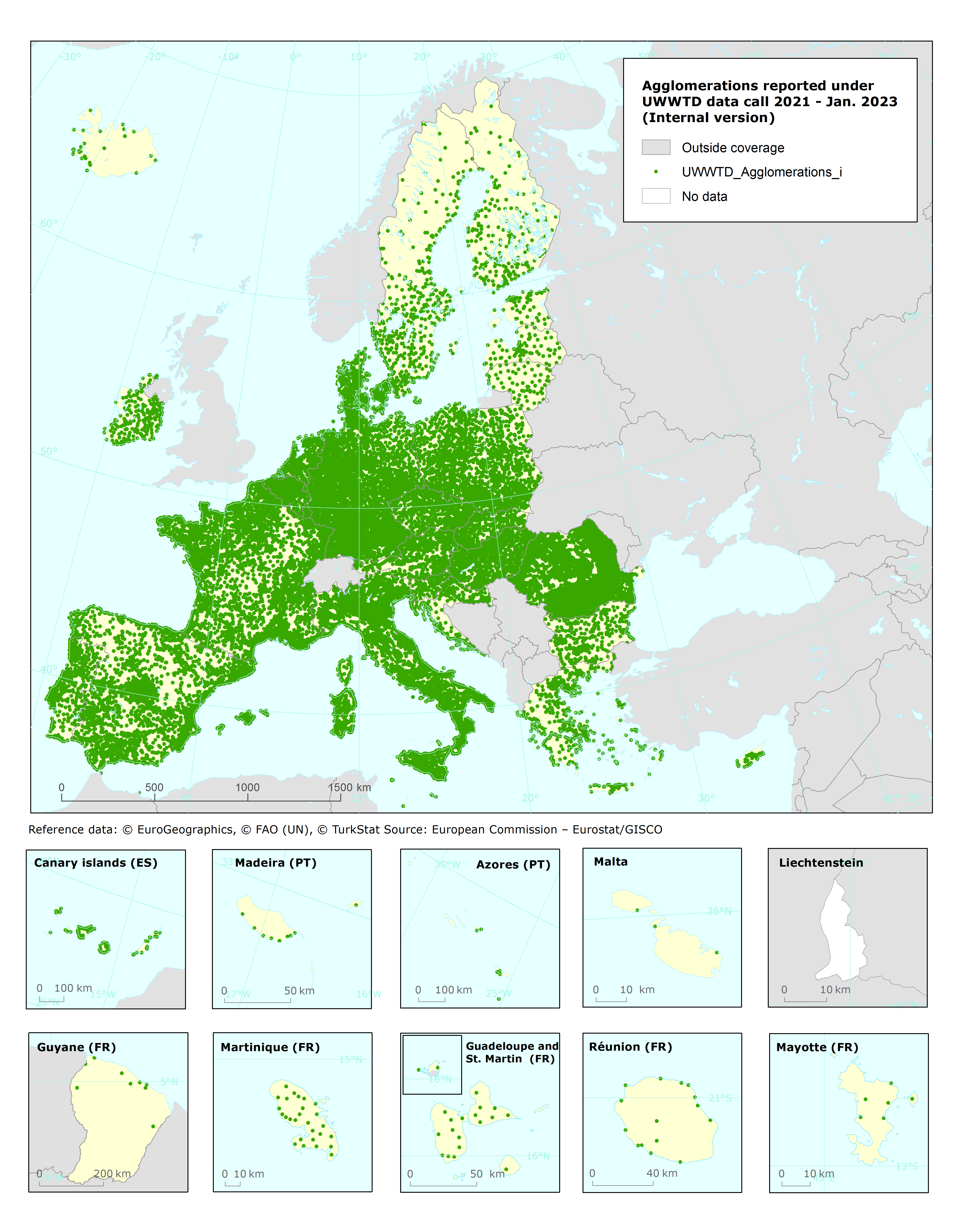
Urban Waste Water Treatment Directive, Agglomerations reported under UWWTD data call 2021 - INTERNAL VERSION, Jan. 2023 (Spatial data)
UWWTD Agglomerations, Jan. 2023 is one of the datasets produced within the frame of the reporting under 12th UWWTD Art.15 reporting period (UWWTD data call 2021).
The Urban Waste Water Treatment Directive (UWWTD) (91/271/EEC) obliges Member States to report data on the implementation of the Directive upon request from the European Commission bi-annually. Reported data include receiving areas as designated under UWWTD, agglomerations, urban waste water treatment plants serving the agglomerations and points of discharges.
Dataset UWWTD_Agglomerations contains agglomerations reported by countries with generated load ≥ 2000 p.e. (or even smaller), including names, coordinates, generated load and information whether the load generated is collected through collecting system or addressed via Individual Appropriate Systems (IAS) or not collected not addressed via IAS.
This metadata refers to the internal dataset which contains all reported agglomerations, including inactive ones. Agglomerations with obviously wrong coordinates were excluded only.
The public dataset excluding inactive agglomerations can be found under the entry "Urban Waste Water Treatment Directive, Agglomerations reported under UWWTD data call 2021 - PUBLIC VERSION, Jan. 2023" ( https://sdi.eea.europa.eu/catalogue/inspire-pds/eng/catalog.search#/metadata/70792661-4f30-4078-aa19-3f0b4e0728ec).
The dataset is provided in GeoPackage and ESRI File geodatabase formats.
The published output contains data reported in 2022. Current output is provisional, as it is subject to the Commission's compliance check, following which some records may be amended and further information will be added.
IMPORTANT NOTE: Public access to this data set is restricted due to intellectual property rights. It shall only be used internally by the EEA, its ETCs and subcontractors working on behalf of the EEA.
Simple
Identification info
- Date (Creation)
- 2022-11-15
- Date (Publication)
- 2023-02-06
- Edition
-
08.00
- Citation identifier
- eea_v_4258_100_m_uwwtd-agglo_i_2019-2020_v08_r00
- Status
- Superseded
- Spatial representation type
- Vector
Spatial resolution
- Spatial resolution
- 100 m
- Topic category
-
- Environment
Extent
))
Temporal extent
- Time period
- 2019-01-01 2020-12-31
- Maintenance and update frequency
- Biannually
- Continents, countries, sea regions of the world.
-
-
Iceland
-
EU27 (from 2020)
-
- INSPIRE priority data set
-
-
Directive 91/271/EEC
-
Agglomerations (Urban Waste Water Treatment Directive)
-
Resource constraints
- Access constraints
- Other restrictions
Resource constraints
- Use constraints
- Other restrictions
- Other constraints
-
The dataset contains parts which should not be made available for public access.
Associated resource
- Association Type
- Revision Of
- Language
- English
- Additional Information
-
The directive imposes different reporting obligations (Situation report according to Article 16 and implementation programme according to Article 17). The data presented in the UWWTD Waterbase pertains to Articles 15 and 17 of the Directive, which stipulates that discharges from urban waste water treatment plants and amounts and composition of sludges disposed to surface waters must be monitored to verify the compliance with specific provisions of the Directive.
Some technical insight and familiarity with the terms and contexts used for the implementation of the UWWTD is required to make use of the tables.
By linking the information in the tables on agglomerations, UWWTPs, discharge points and receiving areas it is possible to obtain a complete picture showing what type of treatment is applied to treat waste water generated in specific agglomeration, what is the character of the area (e.g. water body) receiving discharges from waste water treatment plans or collecting systems without treatment.
The content of the table with additional data can be used for further quantitative analyses on emissions from UWWTPs with different types of treatment and various size categories. A QA-document describes a flagging of some of the provided data according to certain criteria. These flags should be considered by the user for specific purposes.
All the tables from Waterbase can be downloaded for use by all stakeholders according to below Rights. Lists and explanation of codes can also be shown and downloaded from Additional information - Code Lists. Link to further details on reporting guidelines is given from below Reporting Obligations.
Distribution Information
- Distribution format
-
-
Geopackage
-
GDB
-
- OnLine resource
-
Direct download (Eionet authentication)
- OnLine resource
-
EEA website
- OnLine resource
-
WISE GIS Guidance, version 7.0.6
Data quality info
- Hierarchy level
- Dataset
Report
Result
- Title
- Commission Regulation (EU) No 1089/2010 of 23 November 2010 implementing Directive 2007/2/EC of the European Parliament and of the Council as regards interoperability of spatial data sets and services
- Date (Publication)
- 2010-12-08
- Explanation
-
See the referenced specification
Resource lineage
- Statement
-
Agglomerations data were reported by Member states in tabular format. Spatial position of individual agglomeations was specified by the geographical coordinates fields (longitude, latitude). These tabular data were checked, grouped into a common Pan-European dataset and transformed to the spatial data layer in GIS software. Agglomerations with obviously wrong coordinates were removed.
If the agglomeration coordinates were not reported, given agglomeration was not excluded (= missing information, coordinates are unknown); on the transformation from reported tabular format to the spatial point layer in GIS, records with missing coordinates were not transferred to the points visible in the data layer, of course, but they are available in the attribute table and their coordinates aggLatitude and aggLongitude in the attribute table are NULL.
Tabular data is accessible here: https://sdi.eea.europa.eu/data/3a69dbaf-15d8-443d-a0ff-fa2c4bb8ab0d/Tabular/
Description of dataset and definition is acccessible under 'Links'.
- Hierarchy level
- Dataset
Reference System Information
Reference System Information
- Code
- EPSG:4258
Metadata
- Metadata identifier
- c4590c8f-128b-49f0-a6b4-9be988b7758b
- Language
- English
- Character encoding
- UTF8
- Contact
-
Organisation Individual Electronic mail address Website Role European Environment Agency
Point of contact
Type of resource
- Resource type
- Dataset
- Metadata linkage
-
https://sdi.eea.europa.eu/catalogue/srv/api/records/c4590c8f-128b-49f0-a6b4-9be988b7758b
- Date info (Creation)
- 2023-01-06T14:46:20.721Z
- Date info (Revision)
- 2025-10-09T11:13:30.757725Z
Metadata standard
- Title
-
ISO 19115/19139
- Edition
-
1.0
)))