 EEA geospatial data catalogue
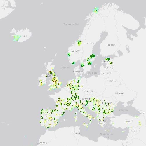
Urban Atlas 2018 (vector), Jan. 2021
The European Urban Atlas provides reliable, inter-comparable, high-resolution land use and land cover data for 785 Functional Urban Area (FUA) with more than 50,000 inhabitants for the 2018 reference year in EEA38 countries (EU, EFTA, Western Balkans countries, as well as Türkiye) and the United Kingdom. The spatial data can be downloaded together with a map for each FUA covered and a report with the metadata for the respective area.
Urban Atlas is a joint initiative of the European Commission Directorate-General for Regional and Urban Policy and the Directorate-General for Defence Industry and Space in the frame of the EU Copernicus programme, with the support of the European Space Agency and the European Environment Agency.
NOTE: By the time of publishing this metadata not all the FUAs were available through the Copernicus Land Service website. The last FUAs were added in January 2021.
Simple
Identification info
- Date (Creation)
- 2020-04-16
- Date (Publication)
- 2020-04-16
- Date (Revision)
- 2021-01-20
- Edition
-
01.02
- Citation identifier
- copernicus_v_3035_10_m_ua-2018_p_2017-2019_v01_r02
- Status
- Obsolete
- Point of contact
-
Organisation Individual Electronic mail address Website Role European Commission
Owner Copernicus Land Monitoring Service
Custodian European Environment Agency
Publisher Copernicus Land Monitoring Service helpdesk
Point of contact
- Spatial representation type
- Vector
Spatial resolution
- Spatial resolution
- 10 m
- Topic category
-
- Environment
- Imagery base maps earth cover
Extent
Temporal extent
- Time period
- 2017-01-01 2019-12-31
Extent
))
Extent
))
Extent
))
- Maintenance and update frequency
- Continual
- GEMET - INSPIRE themes, version 1.0
-
-
Land use
-
- Continents, countries, sea regions of the world.
-
-
EEA38 (from 2020)
-
United Kingdom
-
- GEMET
-
-
urban area
-
landscape alteration
-
land use
-
land cover
-
- EEA topics
-
-
Land use
-
Resource constraints
- Access constraints
- Other restrictions
- Other constraints
- no limitations to public access
Resource constraints
- Use constraints
- Other restrictions
- Other constraints
-
The Copernicus component is governed by Regulation (EU) No 2021/696 of the European Parliament and of the Council of 28 April 2021 establishing the Union Space Programme and the European Union Agency for the Space Programme and repealing Regulations (EU) No 912/2010, (EU) No 1285/2013 and (EU) No 377/2014 and Decision No 541/2014/EU. Within the Copernicus component, a portfolio of land monitoring activities has been delegated by the European Union to the European Environment Agency (EEA) and the DG Joint Research Centre of the European Commission.
The Copernicus land monitoring products and services are made available on a principle of full, open and free access, as established by the Commission Delegated Regulation (EU) No 1159/2013 of 12 July 2013.
Free, full and open access to the products and services of the Copernicus Land Monitoring Service is made on the conditions that:
1. When distributing or communicating Copernicus Land Monitoring Service products and services (data, software scripts, web services, user and methodological documentation and similar) to the public, users shall inform the public of the source of these products and services.
2. Where the Copernicus Land Monitoring Service products and services have been adapted or modified by the user, the user shall clearly state this.
3. Users shall make sure not to convey the impression to the public that the user's activities are officially endorsed by the European Union.
- Language
- English
- Character encoding
- UTF8
- Additional Information
-
Spatial Resolution information: The Minimum Mapping Width is 10 m
Distribution Information
- Distribution format
-
-
Geopackage
-
- Ordering instructions
-
This dataset is no longer accessible from the website of the Copernicus Land Monitoring Service. You can request access to this dataset by contacting the service desk of the Copernicus Land Monitoring Service at JRC-Copernicus-Land@ec.europa.eu.
Data quality info
- Hierarchy level
- Dataset
Report
Result
- Title
-
Commission Regulation (EU) No 1089/2010 of 23 November 2010 implementing Directive 2007/2/EC of the European Parliament and of the Council as regards interoperability of spatial data sets and services
- Date (Publication)
- 2010-12-08
- Explanation
-
See the referenced specification
Resource lineage
- Statement
-
Cartography based on satellite images Interpretation (Pléiades, KOMPSAT, Planet, SPOT6, SuperView, etc. - resolution 2 or 4 meters)
Use of ancillary data (Google Earth, OpenStreet Map).
Production land use/cover maps for Functional Urban Area in Europe.
Typology:
11100 Continuous Urban Fabric (S.L. > 80%)
11210 Discontinuous Dense Urban Fabric (S.L. : 50% - 80%)
11220 Discontinuous Medium Density Urban Fabric (S.L. : 30% - 50%)
11230 Discontinuous Low Density Urban Fabric (S.L. : 10% - 30%)
11240 Discontinuous Very Low Density Urban Fabric (S.L. < 10%)
11300 Isolated Structures
12100 Industrial, commercial, public, military and private units
12210 Fast transit roads and associated land
12220 Other roads and associated land
12230 Railways and associated land
12300 Port areas
12400 Airports
13100 Mineral extraction and dump sites
13300 Construction sites
13400 Land without current use
14100 Green urban areas
14200 Sports and leisure facilities
21000 Arable land (annual crops)
22000 Permanent crops (vineyards, fruit trees, olive groves)
23000 Pastures
24000 Complex and mixed cultivation patterns
25000 Orchards at the fringe of urban classes
31000 Forests
32000 Herbaceous vegetation associations (natural grassland, moors...)
33000 Open spaces with little or no vegetations (beaches, dunes, bare rocks, glaciers)
40000 Wetland
50000 Water bodies
External Quality control realized by IGNFI.
Class 1: 0.25 ha
Class 2 - 5: 1 ha.
The Minimum Mapping Width is 10 m.
Additional information (product description, mapping guidance and class description) can be found here: https://land.copernicus.eu/user-corner/technical-library/urban_atlas_2012_2018_mapping_guide_v6-1.pdf.
- Hierarchy level
- Dataset
Reference System Information
Reference System Information
- Code
- EPSG:3035
Reference System Information
Reference System Information
- Code
- EPSG:32740
Reference System Information
Reference System Information
- Code
- EPSG:32620
- Maintenance and update frequency
Metadata
- Metadata identifier
- c82fc17a-a100-4cc8-b1a8-9d3566f57581
- Language
- English
- Character encoding
- UTF8
- Contact
-
Organisation Individual Electronic mail address Website Role European Environment Agency
Point of contact
Type of resource
- Resource type
- Dataset
- Metadata linkage
-
https://sdi.eea.europa.eu/catalogue/srv/api/records/c82fc17a-a100-4cc8-b1a8-9d3566f57581
- Date info (Creation)
- 2020-05-11T07:35:46Z
- Date info (Revision)
- 2025-10-09T11:14:24.632122Z
Metadata standard
- Title
-
ISO 19115/19139
- Edition
-
1.0
),POLYGON((55.769%20-21.2979,55.769%20-20.7244,55.3183%20-20.7244,55.3183%20-21.2979,55.769%20-21.2979)),POLYGON((-60.6807%2014.3109,-60.6807%2014.9152,-61.2564%2014.9152,-61.2564%2014.3109,-60.6807%2014.3109))))