 EEA geospatial data catalogue
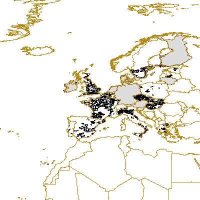
Nitrate Vulnerable Zones
Data on designated nitrate vulnerable zones as submitted by Member States for monitoring progress of implementation of the Nitrate Directive (Council Directive 91/676/EEC of 12 December 1991 concerning the protection of waters against pollution caused by nitrates from agricultural sources). This Directive has the objective of reducing water pollution caused or induced by nitrates from agricultural sources and preventing further such pollution. Waters affected by pollution and waters which could be affected by pollution if action pursuant Article 5 is not taken shall be identified by the Member States in accordance with the criteria set out in Annex I.
Simple
Identification info
- Date
- Date (Creation)
- 2006-06-17
- Edition
-
01.00
- Citation identifier
- jrc_v_4258_100_k_nvz_p_2006_v01_00
- Status
- Superseded
- Spatial representation type
- Vector
Spatial resolution
Equivalent scale
- Denominator
- 100000
- Topic category
-
- Environment
- Geoscientific information
Extent
))
Extent
Temporal extent
- Time period
- 2006-01-01 2006-12-31
- GEMET - INSPIRE themes, version 1.0
-
-
Soil
-
- GEMET
-
-
environment
-
- EEA topics
-
-
Agriculture and food
-
Resource constraints
- Use limitation
-
License
Resource constraints
- Access constraints
- copyright
- Access constraints
- Other restrictions
- Other constraints
-
License
- Language
- English
- Character encoding
- UTF8
Data quality info
- Hierarchy level
- Dataset
Report
Result
- Title
- Commission Regulation (EU) No 1089/2010 of 23 November 2010 implementing Directive 2007/2/EC of the European Parliament and of the Council as regards interoperability of spatial data sets and services
- Date (Publication)
- 2010-12-08
- Explanation
-
See the referenced specification
Resource lineage
- Statement
-
Data quality depends from data provided by Member States
- Hierarchy level
- Dataset
Reference System Information
- Reference system identifier
- OGP Surveying & Positioning Committee/urn:ogc:def:crs:EPSG:7.1:4258
Metadata
- Metadata identifier
- cdb7af74-b12d-49f5-b716-bd64c7a0f864
- Language
- English
- Character encoding
- UTF8
- Contact
-
Organisation Individual Electronic mail address Website Role European Environment Agency
Point of contact
Type of resource
- Resource type
- Dataset
- Metadata linkage
-
https://sdi.eea.europa.eu/catalogue/srv/api/records/cdb7af74-b12d-49f5-b716-bd64c7a0f864
- Date info (Creation)
- 2010-08-02T14:04:30Z
- Date info (Revision)
- 2025-10-09T11:15:30.776234Z
Metadata standard
- Title
-
ISO 19115/19139
- Edition
-
1.0
)))