 EEA geospatial data catalogue
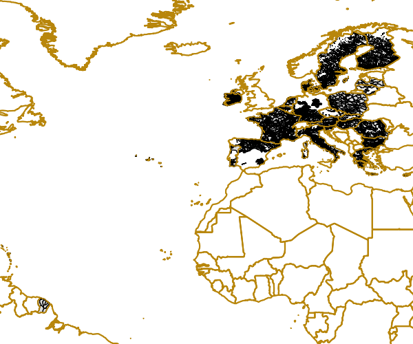
WISE provisional reference GIS Water Framework Directive (WFD) dataset on Groundwater Bodies - PUBLIC VERSION, Oct. 2012
A Groundwater Body (GWB) under the Water Framework Directive (WFD) Art. 2 is defined as a distinct volume of groundwater within an aquifer or aquifers, whereas an aquifer is defined as a geological layer with significant groundwater flow. This definition of a GWB allows a wide scope of interpretations.
EU Member States (MS) are under obligation to report the GWBs including the results of the GWB survey periodically according to the schedule of the WFD. Reportnet is used for the submission of GWB data to the EEA by MS and includes spatial data as GIS polygons and GWB characteristics in an XML schema.
The WISE provisional reference GIS WFD Dataset on GWBs combines spatial data consisting of several shape files and certain GWB attributes in a single table submitted by the MS according to Art. 13. The GWBs are divided into horizons, which represent distinct vertical layers of groundwater resources. All GWBs assigned to a certain horizon from one to five are merged into one shape file. GWBs assigned to horizons six or seven are combined in a single further shape file. Another two shape files comprise the GWBs of Reunion Island in the southern hemisphere and the GWBs from Switzerland as a non EU MS, all of which assigned to horizon 1.
The dbf tables of the shape files include the columns “EU_CD_GW” as the GWB identifier and “Horizon” describing the vertical positioning. The polygon identifier “Polygon_ID” was added subsequently, because some GWBs consist of several polygons with identical “EU_CD_GW”even in the same horizon.
Some further GWB characteristics are provided with the Microsoft Excel file “GWB_attributes_2012June.xls” including the column “EU_CD_GW”, which serves as a key for joining spatial and attribute data. There is no corresponding spatial data for GWBs in the Microsoft Excel table without an entry in column “EU_CD_GW”.
The spatial resolution is given for about a half of the GWBs in the column “Scale” of the xls file, which is varying between the MS from 1 : 10,000 to 1 : 1,000,000 and mostly in the range from 1 : 50,000 to 1 : 250,000.
The processing of some of the GWB shape files by GIS routines as clip or intersect in combination with a test polygon resulted in errors. Therefore a correction of erroneous topological features causing routine failures was carried out.
However, the GWB layer includes a multitude of in parts very tiny, distinct areas resulting in a highly detailed or fragmented pattern. In certain parts topological inconsistencies appear quite frequently and delineation methodologies are currently varying between the MS in terms of size and three dimensional positioning of GWBs.
This version of the dataset has to be considered as a first step towards a consistent GWB picture throughout Europe, but it is not yet of a sufficient quality to support spatial analyses i.e. it is not a fully developed reference GIS dataset. Therefore, the layer is published as a preliminary version and use of this data is subject to certain restrictions outlined in the explanatory notes.
It should be underlined that the methodology used is still under discussion (Working Group C -Groundwater) and is not fully harmonised throughout the EU MS.
For the external publication the whole United Kingdom had to be removed due to licensing restrictions.
Simple
Identification info
- Date (Creation)
- 2012-10-17
- Citation identifier
- eea_v_xxx_1_mio_wise-gbd-public_2009-2011
- Status
- Obsolete
- Point of contact
-
Organisation Individual Electronic mail address Website Role European Environment Agency
Point of contact European Environment Agency
Custodian
- Spatial representation type
- Vector
Spatial resolution
Equivalent scale
- Denominator
- 1000000
- Topic category
-
- Inland waters
Extent
))
Extent
Temporal extent
- Time period
- 2009-01-01 2011-12-31
- Maintenance and update frequency
- Irregular
- GEMET - INSPIRE themes, version 1.0
-
-
Hydrography
-
Area management/restriction/regulation zones and reporting units
-
- GEMET
-
-
groundwater
-
aquifer
-
hydrography
-
- EEA topics
-
-
Water
-
Resource constraints
- Use constraints
- Other restrictions
- Other constraints
-
License CC-BY 4.0 ( https://creativecommons.org/licenses/by/4.0/). Copyright holder: European Environment Agency (EEA).
Resource constraints
- Access constraints
- Other restrictions
- Other constraints
- no limitations to public access
Associated resource
- Association Type
- Is composed of
- Metadata Reference
Associated resource
- Association Type
- Is composed of
- Metadata Reference
Associated resource
- Association Type
- Is composed of
- Metadata Reference
Associated resource
- Association Type
- Is composed of
- Metadata Reference
Associated resource
- Association Type
- Is composed of
- Metadata Reference
Associated resource
- Association Type
- Is composed of
Associated resource
- Association Type
- Is composed of
- Metadata Reference
Associated resource
- Association Type
- Is composed of
- Metadata Reference
Associated resource
- Association Type
- Is composed of
- Metadata Reference
- Language
- English
- Character encoding
- UTF8
Distribution Information
- Distribution format
-
-
SHP
-
Data quality info
- Hierarchy level
- Dataset
Report
Result
- Title
-
Commission Regulation (EU) No 1089/2010 of 23 November 2010 implementing Directive 2007/2/EC of the European Parliament and of the Council as regards interoperability of spatial data sets and services
- Date (Publication)
- 2010-12-08
- Explanation
-
See the referenced specification
Resource lineage
- Statement
-
Spatial data of GWBs was delivered by MS in a shape format, whereas many MS stored the data in separate shape files for River Basin Districts (RBD) or horizons or both. The attribute tables of the provided shape files always implied the mandatory fields of GWB code named “EU_CD_GW” and GWB horizon partially accompanied by varying extra columns defined by the Member States.
All GWBs had been merged into separate shape files according to their affiliation to horizons, but with extra shapes for Reunion and Switzerland. The attribute tables of these shape files exclusively adopt the fields “EU_CD_GW” and GWB. Because the GWB identifier “EU_CD_GW” is not unique for the polygons an artificial polygon identifier “Polygon_ID” is appended to the attribute table.
The linking between the shape files and the Microsoft Excel table GWB_attributes_2012June.xls, which comprises further attributes deriving from the WFD reporting via XML files, has to be carried out using the column EU_CD_GW as key for joining the tables.
- Hierarchy level
- Dataset
Reference System Information
Reference System Information
- Code
- EPSG:3035
Metadata
- Metadata identifier
- 01c9d364-6c84-4b3f-8feb-1b99eff56e07
- Language
- English
- Character encoding
- UTF8
- Contact
-
Organisation Individual Electronic mail address Website Role European Environment Agency
Point of contact
Type of resource
- Resource type
- Dataset
- Metadata linkage
-
https://sdi.eea.europa.eu/catalogue/srv/api/records/01c9d364-6c84-4b3f-8feb-1b99eff56e07
- Date info (Creation)
- 2012-10-18T11:59:15Z
- Date info (Revision)
- 2025-10-09T10:34:14.310435Z
Metadata standard
- Title
-
ISO 19115/19139
- Edition
-
1.0
)))