 EEA geospatial data catalogue
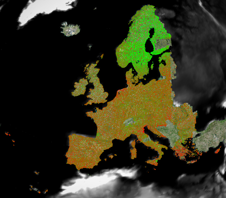
European Ground Motion Service (EGMS)
The European Ground Motion Service (EGMS) provides consistent and reliable information regarding natural and anthropogenic ground motion over the Copernicus participating states and across national borders, with millimeter accuracy.
The EGMS distributes three levels of products updated annually: basic, calibrated and ortho.
The EGMS distributes three product levels updated annually:
Basic. Line of sight velocity maps in ascending and descending orbits with annotated geolocalisation and quality measures per measurement point. Velocities in the basic products are referred to a local reference point.
Calibrated. Line of sight velocity maps in ascending and descending orbits referenced to a model derived from global navigation satellite systems data. Calibrated velocities are absolute, being no longer relative to a local reference point.
Ortho. Components of motion (horizontal and vertical) anchored to the reference model used above. Ortho products are resampled to a 100 m grid.
The EGMS is part of the European Union’s Copernicus Land Monitoring Service.
Simple
Identification info
- Date (Publication)
- 2024-10-29
- Citation identifier
- copernicus_egms_s
- Point of contact
-
Organisation Individual Electronic mail address Website Role Copernicus Land Monitoring Service
Custodian European Environment Agency
Publisher
- Spatial representation type
- Vector
- Topic category
-
- Geoscientific information
Extent
))
))
))
))
))
Temporal extent
- Time period
- 2015-02-01 2020-12-31
Temporal extent
- Time period
- 2015-02-01 2021-12-31
Temporal extent
- Time period
- 2015-02-01 2023-01-01
Temporal extent
- Time period
- 2018-01-01 2022-12-31
Temporal extent
- Time period
- 2018-02-01 2022-12-31
Temporal extent
- Time period
- 2019-01-01 2023-12-31
- Continents, countries, sea regions of the world.
-
-
Norway
-
EU27 (from 2020)
-
Iceland
-
United Kingdom
-
EEA38 (from 2020)
-
- EEA Management Plan
-
-
2023 6.5.32
-
2024 6.5.32
-
- EEA topics
-
-
Land use
-
Buildings and construction
-
Production and consumption
-
- GEMET
-
-
geological process
-
landslide
-
built environment
-
subsidence
-
earth observation
-
risk reduction
-
geo-referenced data
-
urban area
-
infrastructure
-
calibration
-
geodesy
-
model
-
geo-referenced information
- risk reduction
- subsidence
- earth observation
- infrastructure
- geo-referenced data
- landslide
- geological process
- urban area
- built environment
-
- GEMET - INSPIRE themes, version 1.0
-
-
Natural risk zones
- Natural risk zones
-
- Temporal resolution
-
-
Weekly
-
Not planned
-
Associated resource
- Association Type
- Is composed of
Associated resource
- Association Type
- Is composed of
Associated resource
- Association Type
- Is composed of
Associated resource
- Association Type
- Is composed of
Associated resource
- Association Type
- Is composed of
Associated resource
- Association Type
- Is composed of
Associated resource
- Association Type
- Is composed of
Associated resource
- Association Type
- Is composed of
Associated resource
- Association Type
- Is composed of
Associated resource
- Association Type
- Is composed of
Associated resource
- Association Type
- Is composed of
Associated resource
- Association Type
- Is composed of
Associated resource
- Association Type
- Is composed of
Associated resource
- Association Type
- Is composed of
Associated resource
- Association Type
- Is composed of
Associated resource
- Association Type
- Is composed of
Associated resource
- Association Type
- Is composed of
Associated resource
- Association Type
- Is composed of
Metadata
- Metadata identifier
- b67d6289-bc0b-486b-b4ce-d08eb397d337
- Language
- English
- Character encoding
- UTF8
- Contact
-
Organisation Individual Electronic mail address Website Role European Environment Agency
Point of contact
Type of resource
- Resource type
- Series
- Metadata linkage
-
https://sdi.eea.europa.eu/catalogue/srv/api/records/b67d6289-bc0b-486b-b4ce-d08eb397d337
- Date info (Creation)
- 2023-01-31T10:47:00.29Z
- Date info (Revision)
- 2026-01-06T11:27:47.691089Z
Metadata standard
- Title
-
ISO 19115-3:2018
- Edition
-
1.0
),POLYGON((44.86%2027.6,44.86%2071.21,-31.3%2071.21,-31.3%2027.6,44.86%2027.6)),POLYGON((-51.28%201.05,-51.28%2016.9,-62%2016.9,-62%201.05,-51.28%201.05)),POLYGON((-51.28%201.08,-51.28%2016.9,-62%2016.9,-62%201.08,-51.28%201.08)),POLYGON((56.25%20-21.6,56.25%20-12.45,44.75%20-12.45,44.75%20-21.6,56.25%20-21.6))))